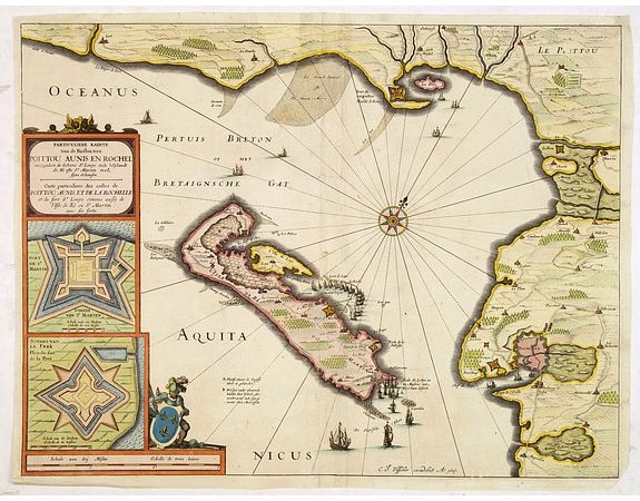
VISSCHER, C. J. - Carte Particulière des costes de Poittou Aunis, et de la Rochelle et du fort St. Louys comme aussy de l'Isle de Ré avec ses forts.

VISSCHER, C. J. - Carte Particulière des costes de Poittou Aunis, et de la Rochelle et du fort St. Louys comme aussy de l'Isle de Ré avec ses forts.
Published: Amsterdam, 1627
Size: 395 x 523mm.
Color: Coloured.
Condition: Piece of paper next to upper part of centerfold re-inforced and missing area carefully redrawn. Some paper thinness along center fold.
Description
Very rare map of Poitou-Charentes with Île de Ré and the French coast with La Rochelle., oriented to the Northwest. With two inset fortification plans: Fort de la Pree and Fort de St Martin.
Shows the battle situation between the French and the English in 1627. Title cartouche with title in French and Dutch. Published et engraved by the founder, Claes Jansz Visscher (1587-1652), of the well known family business.
Shows the battle situation between the French and the English in 1627. Title cartouche with title in French and Dutch. Published et engraved by the founder, Claes Jansz Visscher (1587-1652), of the well known family business.
2,500€
- See other items by this publisher: VISSCHER, C. J.
- Reference N°: 32247
3365 views
 Click on image to zoom
