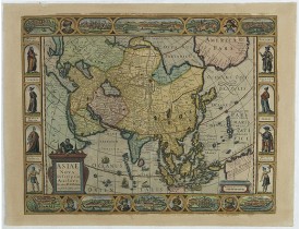
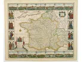
Carte-à-figures maps
The Silk Road extended approximately 6,437 kilometers (4,000 miles) across some of the world’s most formidable landscapes, including the Gobi Desert, the Pamir Mountains and traversed several of Uzbekistan’s major cities, including Samarkand, Bukhara and Khiva. The roads were typically in poor condition. Robbers were common. To protect themselves, traders joined together in caravans with camels or other pack animals. Over time, large inns called caravanserais cropped up to house travelling merchants.
One of the most famous travelers of the Silk Road was Marco Polo (1254 C.E. –1324 C.E.). Born into a family of wealthy merchants in Venice, Italy, Marco traveled with his father to China (then Cathay) when he was just 17 years of age.
It is hard to overstate the importance of the Silk Road on history. Religion and ideas spread along the Silk Road just as fluidly as goods. Towns along the route grew into multicultural cities.
The exchange of information gave rise to new technologies and innovations that would change the world.
The below antique maps are available for immediate sale, they are sold with a certificate of authenticity and published at the date indicated in the catalog description.
One of the most famous travelers of the Silk Road was Marco Polo (1254 C.E. –1324 C.E.). Born into a family of wealthy merchants in Venice, Italy, Marco traveled with his father to China (then Cathay) when he was just 17 years of age.
It is hard to overstate the importance of the Silk Road on history. Religion and ideas spread along the Silk Road just as fluidly as goods. Towns along the route grew into multicultural cities.
The exchange of information gave rise to new technologies and innovations that would change the world.
Antique maps including the Silk Route region
The below antique maps are available for immediate sale, they are sold with a certificate of authenticity and published at the date indicated in the catalog description.
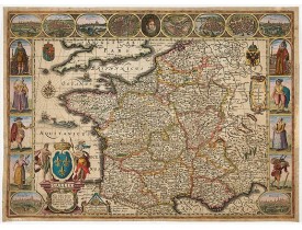
Location: 1616
Published: Amsterdam, 1616
Size: 405 x 553 mm.
Color: Coloured.
Condition: Laid down on another sheet of paper. Minor lack of paper in the right hand margin. Good and dark impression.
Map of France with figures on three sides with views of cities, portraits (Henri IV and Marie de Medicis) and costumes. The m..
2,500€
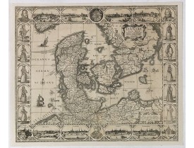
Location: 1630
Published: Amsterdam, 1630
Size: 460 x 550 mm.
Color: Uncoloured.
Condition: Cut to neat lined, and with added margins and a few small areas repaired. Paper slightly age toned. Good and dark impression of this highly decorative and rare map.
PISCATOR or VISSCHER,C.J. - Daniae regni typum - 42904 - Denmark - PISCATOR or VISSCHER,C.J. - Daniae regni typum - 42904 - ..
1,500€
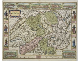
Location: 1630
Published: Amsterdam, 1630
Size: 408 x 532mm.
Color: Coloured.
Condition: A good and dark impression.
A most decorative map with panoramic views of Lucern, S.Gal, Bern, Solothurn, Schafhausen in upper border and Basel and Zuric..
3,000€
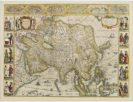
Location: 1632
Published: Amsterdam, 1632
Size: 410 x 550 mm.
Color: Coloured.
Condition: Paper slightly age toned. Some shine-thru of text on verso. Very good condition.
JANSSONIUS, J. - Asia recens summa cura delineata. - 24711 - Asia continent - JANSSONIUS, J. - Asia recens summa cura deline..
4,000€
Location: 1636
Published: Amsterdam, 1636
Size: 435 x 555mm.
Color: In original colours.
Condition: Paper slightly browned. Cut to neat line, partly within outer border and remargined for protective reason. Some repaired tears and small missing area's redrawn. Making nice presentation.
Final State of Pieter Van Den Keere's Rare Map of Asia--The first map of Asia to include decorative panels.The map has an int..
2,800€
Location: 1660
Published: Amsterdam, 1660
Size: 466 x 557 mm.
Color: In attactive original colours.
Condition: Paper very minor age toned. A good impression in stunning colours. Repair of 3 tears in lower margin.
Carte de France à bordures dédiée à Louis XIV. Ces bordures comprennent 14 vues de villes et 8 médaillons figurant le roi et ..
3,200€
Showing 1 to 6 of 6 (1 Pages)

