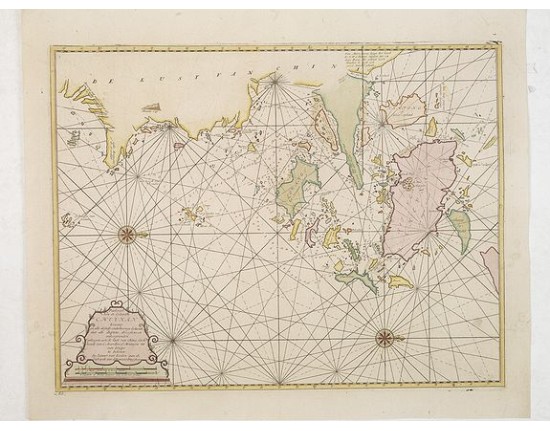
VAN KEULEN, G. - Paskaart van de Eijlanden Cheuxan Lowang en alle deselfs onderhoorige Eylande. . .
 Click on image to zoom

VAN KEULEN, G. - Paskaart van de Eijlanden Cheuxan Lowang en alle deselfs onderhoorige Eylande. . .
Published: Amsterdam, 1753
Size: 410 x 535mm.
Color: In original colours.
Condition: Paper slightly age-toned. Several wormholes filled in, hardly notable. Very good throughout.
Description
A rare and finely engraved and detailed chart of China's Zhejiang Province. Very rare: only included in 6th volume (so-called secret atlas) of Van Keulen's.
Latitude scale, compass rose and system of rhumb lines, soundings, anchorage's, etc. Many Dutch names and a wealth of cities and information appear in the chart.
The van Keulen family operated a chart-making and publishing firm in Amsterdam for nearly 200 years. It was founded by Johannes van Keulen who registered his business as a "bookseller and cross-staff maker." Under his management the Nieuwe Lichtende Zee-Faakel (New Shining Sea Torch) was begun in 1681. It was expanded to five volumes, and finally to six volumes with the addition of material from the secret files of the V.O.C. (Dutch East India Company.) This chart, much more detailed than the standard sold charts, was only published in the secret atlas of the East India Company for their own internal use around 1753.
Zhejiang province, located on the East China sea, just below the Yangtze Delta with Shanghai, this region was of major interest to European traders during the eighteenth-century. It features the major port of Zhousan (Chusan), and was the location of the entrance of the Grand Canal of China.
4,500€
- See other items by this publisher: VAN KEULEN, G.
- Reference N°: 31302
