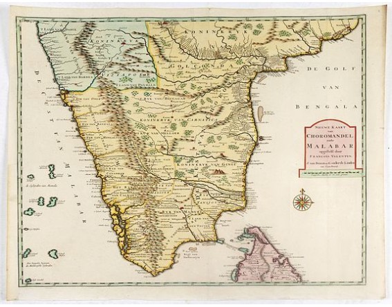
VALENTIJN, F. - Nieuwe Kaart van Choromandel ende Malabar. . .
 Click on image to zoom

VALENTIJN, F. - Nieuwe Kaart van Choromandel ende Malabar. . .
Published: Amsterdam, 1726
Size: 273 x 360mm.
Color: Uncoloured.
Condition: Folds as issued. Dark impression. In very good condition.
Description
Fine map depicting the southern part of India and the northern tip of Ceylon. Much detail is given along the coastlines, settlements and principal coastal features are identified. An attractive early map, one of the few early Dutch maps to focus on the region.
François Valentijn (1666-1727), a missionary, worked at Amboina from 1684 to 1694 and 1705 to 1713 and traveled extensively in the VOC's lands. He is best known for his monumental history and description, ''Oud en Nieuw Oost-Indiën'' which remains one of the most important primary sources for the East Indies and neighboring lands.
François Valentijn (1666-1727), a missionary, worked at Amboina from 1684 to 1694 and 1705 to 1713 and traveled extensively in the VOC's lands. He is best known for his monumental history and description, ''Oud en Nieuw Oost-Indiën'' which remains one of the most important primary sources for the East Indies and neighboring lands.
5,000€
- Reference N°: 35913
