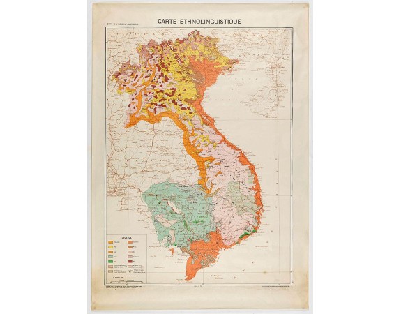
SERVICE GÉOGRAPHIQUE DE L'INDOCHINE. - Carte de l'Indochine au 1 : 2.000.000. Carte ethnolinguistique.

Out Of Stock
SERVICE GÉOGRAPHIQUE DE L'INDOCHINE. - Carte de l'Indochine au 1 : 2.000.000. Carte ethnolinguistique.
Published: Hanoï, 1949
Size: 840 x 605mm.
Color: In printed colours.
Condition: In fine condition.
Description
Map showing Vietnam, Cambodia, and Laos, prepared under the direction of "l'Ecole Française d'Extrême-Orient". Relief shown by spot heights. With a coloured key referring to the different populations and languages.
Important ethnolinguistic and ethnographic map of Indochina published in 1949.
Important ethnolinguistic and ethnographic map of Indochina published in 1949.
0€
- Reference N°: 45654
3964 views
 Click on image to zoom
