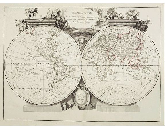
SANTINI, P. / REMONDINI, M. - Mappa Monde ou description du globe terrestre ..

Out Of Stock
SANTINI, P. / REMONDINI, M. - Mappa Monde ou description du globe terrestre ..
Published: Venice, 1776 - 1784
Size: 470 x 650mm.
Color: Original o/l colour.
Condition: Printed on heavy paper with large margins. Good impression. Very good condition.
Description
Double hemisphere world map. California is not an island anymore, but a large Mer de l'Ouest is shown. Delineation between New Holland (Australia) and New Guinea is not yet determined.
The coastlines of North and South America have some place names but inland, the map is almost bare. The map tracks many known sea explorations, like Admiral Anson's in 1743, and Magellan's in 1520.
The map was prepared by the Venetian cartographer and publisher François (Père) Santini and first published in Santini's’Atlas Universel dresse sur les meuilleures cartes modernes 1776.'
Santini collaborated with Janvier and gives credit to him on most of his maps. The atlas is effectively an Italian copy of the Robert de Vaugondy 'Atlas Universel'.
In 1784 Santini sold the plates to M. Remondini, whose name appears on this particular example. ¤
0€
- See other items by this publisher: SANTINI, P. / REMONDINI, M.
- Reference N°: 25069
122 views
 Click on image to zoom
