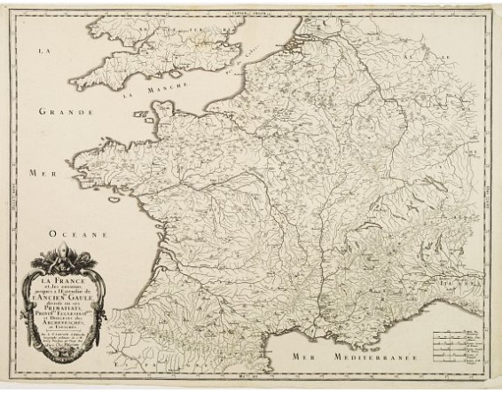
SANSON,N./ MARIETTE,P. - La France et les environs, jusques a l'Estendue de l'Ancienne Gaule..
 Click on image to zoom

SANSON,N./ MARIETTE,P. - La France et les environs, jusques a l'Estendue de l'Ancienne Gaule..
Published: Paris, ca.1650
Size: 440 x 572mm.
Color: Uncoloured.
Condition: Split upper and lower right corner, not affecting the engraved area. Margins cut close. A good and dark impression.
Description
Major cities, towns, waterways, mountains and islands are located. Showing southern part of Great-Britain and northern part of Spain. Very nice and decorative title cartouche lower left.
Sanson, the leading 17th century French cartographer, was official mapmaker to Louis XIV. One of his duties was to tutor the King in geography. “It is generally accepted that the great age of French cartography originated with the work of Nicholas Sanson…” (Moreland & Bannister: Antique Maps, p.128).
Sanson, the leading 17th century French cartographer, was official mapmaker to Louis XIV. One of his duties was to tutor the King in geography. “It is generally accepted that the great age of French cartography originated with the work of Nicholas Sanson…” (Moreland & Bannister: Antique Maps, p.128).
250€
- Reference N°: 61335
