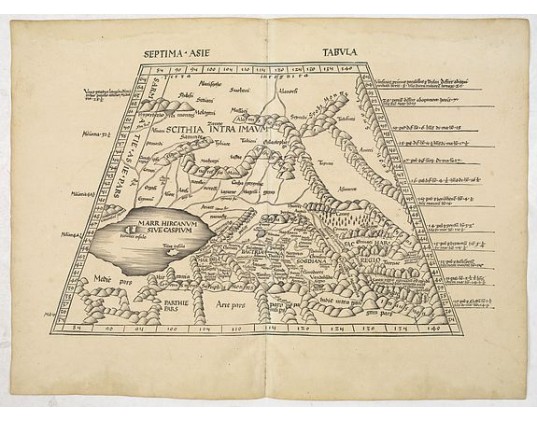
PTOLOMY, C. / WALDSEEMÜLLER, M. - Septima Asie Tabula (Central Asia.)
 Click on image to zoom

Description
Central Asia and Turkistan, with a horizontal delineation of the Caspian Sea. Turkistan, the mystical land of Samarkand, was the farthest known reaches of the world, as known to Ptolemy. The map shows the mountainous area of Pamir and Imaus in the east, with the trade routes through the tribal areas of Bactria and Sogdiana with Scythia to the north and the Caspian Sea to the west.
“This complex territory constituted the Silk Road, a network of overland trails from China to the Mediterranean. Embracing parts of today’s Iran, China, India and the central Asian countries of the former Soviet Union, mysteries about the region’s geography and ethnology persisted until the end of the nineteenth century”. See: Nebenzahl, Mapping the Silk Road.
The Sogdian city-states, although never politically united, were centered on the city of Samarkand.
Sogdians also lived in Imperial China and rose to prominence in the military and government of the Chinese Tang dynasty (618–907 AD). Sogdian merchants and diplomats traveled as far west as the Byzantine Empire. They played an essential part as middlemen in the Silk Road trade route.
From the 1513 edition of Waldseemüller's Geographia.
This Ptolemaic map comes from the first so-called 'Modern Atlas' by the most famous of all early sixteenth-century cosmographers Martin Waldseemüller.
The Atlas is titled GEOGRAPHIE OPUS NOVISSIMA TRADUCTIONE E GRECORUM ARCHETYPIS and was published by Johannes Schott in Strasburg in 1513. It is one of the most important editions of Ptolemy's Atlases.
Read more about Ptolemy and Waldseemüller.
- Reference N°: 33770
