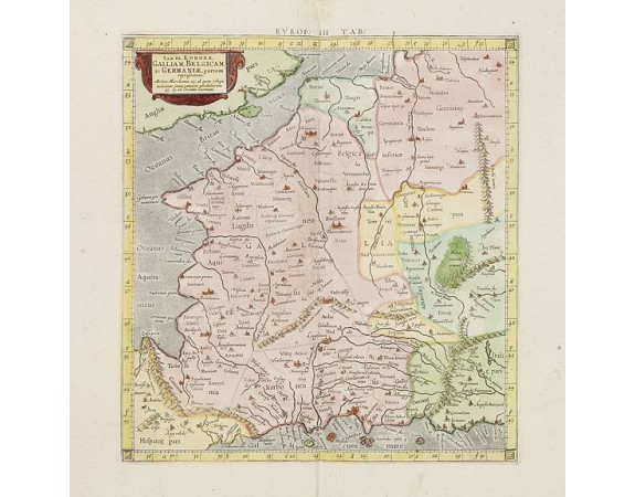
PTOLEMY / MERCATOR, G. - Tab. III. Europae, Galliam, Belgicam, ac Germaniae, Partem Representans . . .
 Click on image to zoom

PTOLEMY / MERCATOR, G. - Tab. III. Europae, Galliam, Belgicam, ac Germaniae, Partem Representans . . .
Published: Utrecht, ca. 1695
Size: 335 x 315mm.
Color: Coloured.
Condition: In very good condition.
Description
A handsome Ptolemaic map of France and Belgium, showing a partial coastline of England.
Mercator originally published this map in his 1578 edition of Ptolemy's great Geography. He is most renowned today for the projection he popularized and for first using the term Atlas for a collection of maps.
Mercator originally published this map in his 1578 edition of Ptolemy's great Geography. He is most renowned today for the projection he popularized and for first using the term Atlas for a collection of maps.
400€
- Reference N°: 27490
