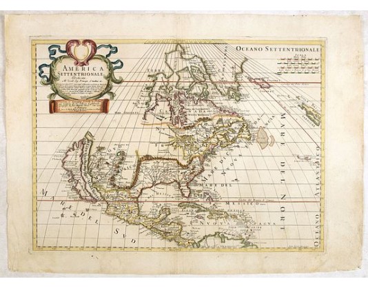
PETRINI, P. - America settentrionale. . .
 Click on image to zoom

PETRINI, P. - America settentrionale. . .
Published: Napels, 1766
Size: 390 x 543mm.
Color: Coloured.
Condition: A good and dark impression. Very good, with large margins.
Description
Rare map of North America drawn directly from the work of Nicholas De Fer and N. Sanson's famous map of 1650. The map is engraved by Antonius Donzel Gallus.
With open Great Lakes, California as an island, limited knowledge of the Mississippi River. Quivira appears east of the Rio Grande, which is shown flowing in to the Gulf of California.
The island of California includes over 20 place names, including P. de S. Diego, Canal de S. Barbara, I. De S. Catalina, Pta de Monte Rey, Pta. De Francisco Draco, and other modern place names.
Lake Michigan? Is Lago De Puzolenti and Lake Huron is Mar Dolce. Many Indian Names appear.
This is the first edition of the map, which includes the second reference to Petrini in the lower part of the title cartouche, which is removed in the 2nd edition. ¤
1,750€
- See other items by this publisher: PETRINI, P.
- Reference N°: 35172
