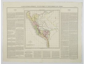
Peru
The Silk Road extended approximately 6,437 kilometers (4,000 miles) across some of the world’s most formidable landscapes, including the Gobi Desert, the Pamir Mountains and traversed several of Uzbekistan’s major cities, including Samarkand, Bukhara and Khiva. The roads were typically in poor condition. Robbers were common. To protect themselves, traders joined together in caravans with camels or other pack animals. Over time, large inns called caravanserais cropped up to house travelling merchants.
One of the most famous travelers of the Silk Road was Marco Polo (1254 C.E. –1324 C.E.). Born into a family of wealthy merchants in Venice, Italy, Marco traveled with his father to China (then Cathay) when he was just 17 years of age.
It is hard to overstate the importance of the Silk Road on history. Religion and ideas spread along the Silk Road just as fluidly as goods. Towns along the route grew into multicultural cities.
The exchange of information gave rise to new technologies and innovations that would change the world.
The below antique maps are available for immediate sale, they are sold with a certificate of authenticity and published at the date indicated in the catalog description.
One of the most famous travelers of the Silk Road was Marco Polo (1254 C.E. –1324 C.E.). Born into a family of wealthy merchants in Venice, Italy, Marco traveled with his father to China (then Cathay) when he was just 17 years of age.
It is hard to overstate the importance of the Silk Road on history. Religion and ideas spread along the Silk Road just as fluidly as goods. Towns along the route grew into multicultural cities.
The exchange of information gave rise to new technologies and innovations that would change the world.
Antique maps including the Silk Route region
The below antique maps are available for immediate sale, they are sold with a certificate of authenticity and published at the date indicated in the catalog description.
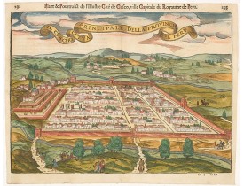
Location: 1564
Published: Lyons, 1564
Size: 270 x 378mm.
Color: Coloured.
Condition: Wood block print with letter press. Centerfold on verso reinforced for protective reason. Fine.
A very desirable and scarce item of this decorative and early bid's-eye town-plan of the Inca city of Cuzco. Several figures ..
550€
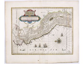
Location: 1644
Published: Amsterdam, 1644
Size: 375 x 490mm.
Color: In attractive strong original colours.
Condition: Very good condition, with a dark impression. French text on verso.
FIRST EDITION, FIRST ISSUE OF THIS MAP. Decorated with ships and monsters in the sea. Orientated with east at the top. With t..
800€
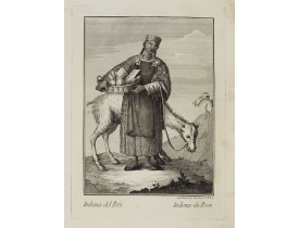
Location: 1790
Published: Venice, Antonio Zatta, c.1790
Size: 255 x 170 mm.
Color: Uncoloured.
Condition: With some foxing in the right margin. Good impression. Else good condition.
VIERO, Th. - Indiana del Perù. / Indienne du Perou. - 26390 - Peru - VIERO, Th. - Indiana del Perù. / Indienne du Perou. - ..
300€
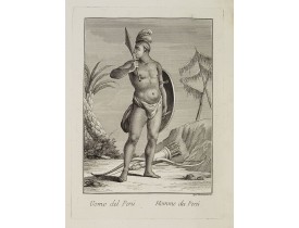
Location: 1790
Published: Venice, Antonio Zatta, c.1790
Size: 255 x 170 mm.
Color: Uncoloured.
Condition: With some foxing in the right margin. Good impression. Else good condition.
VIERO, Th. - Uomo del Perù. / Homme du Perou. - 26391 - Peru - VIERO, Th. - Uomo del Perù. / Homme du Perou. - 26391 - Peru..
300€
Location: 1825
Published: Paris, 1825
Size: 450 x 625 mm.
Color: In original colours.
Condition: In mint condition. Wide margins etc.
BUCHON, J. A. - Carte Geographique, Statistique et Historique du Perou. - 44073 - Peru - BUCHON, J. A. - Carte Geographique,..
100€
Location: 1851
Published: Vienna (Austria), 1851
Size: 430 x 550mm.
Color: Printed colors
Condition: Oblong large folio. Atlas volume only. Green half-chagrin, 5-ribbed spine (Period binding). 60 chromolithographic and tinted lithograph plates including illustrated title page. Binding used. Spine, headbands and corners rubbed. Front cover partly separating, front marbled endpaper loose. Plates minor foxing at edges.
Atlas illustrated with 60 chromolithographic and tinted lithograph plates including illustrated title page.This atlas volume ..
2,000€
Showing 1 to 6 of 6 (1 Pages)

