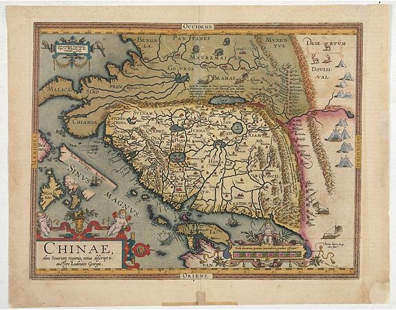
ORTELIUS, A. - Chinae, olim Sinarum Regionis, nova descriptio. Auctore Ludovico Georgio.

ORTELIUS, A. - Chinae, olim Sinarum Regionis, nova descriptio. Auctore Ludovico Georgio.
Published: Antwerp, 1608
Size: 365 x 470mm.
Color: Coloured
Condition: 4to. 2 parts in one vol. General title with woodcut printers device, two section titles with diagrams of globes, 32 woodcut diagrams in the text. Very light marginal browning. Contemporary vellum, lightly stained.
Description
The first map of China ever to appear in a Western atlas, west to the top. When this map appeared, it was by far the most accurate one of China.
Japan is shown on a curious curved projection reminiscent of Portuguese charts of the period with Honshu dissected along the line of Lake Biwa. The Great Wall is shown, as are the Tartar "yurts" dotted across the plains and steppes of Central and East Asia.
The text on verso includes four transcriptions of Chinese characters, brought back to Europe by the Jesuit Bernadino Escalante, published in Sevilla in 1577.
4 wind wagons on the right and top of the map, perhaps the earliest examples of a depiction of this device, which in Europe is certain to have originated in the Low Countries, but which had been invented much earlier in China.
Drawn by Ludovicus Georgius, also called Luis Jorge de Barbuda.
5,500€
- See other items by this publisher: ORTELIUS, A.
- Reference N°: 43851
1848 views
 Click on image to zoom
