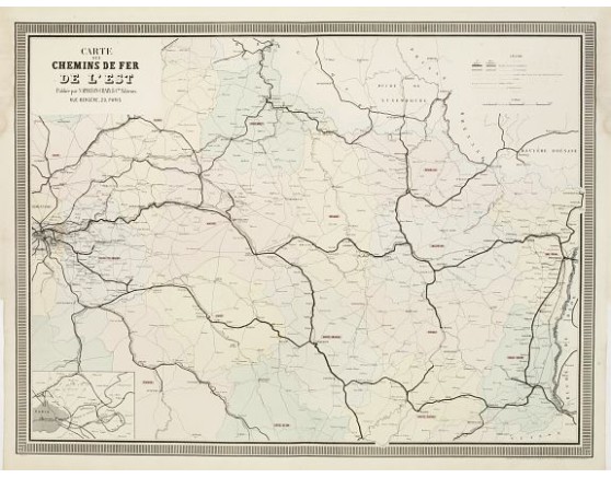
NAPOLÉON CHAIX. - Carte des Chemins de Fer de l'Est.
 Click on image to zoom

NAPOLÉON CHAIX. - Carte des Chemins de Fer de l'Est.
Published: Paris, 1863
Size: 630 x 840mm.
Color: Original colours.
Condition: Originally hand-colored lithography. Faint water stain in the upper corners, not affecting the printed area. Good margins. Very good condition.
Description
Fine map showing the early railway system of a large area extending eastwards from Paris as far as Strasbourg and Basel.
With small inset map of Paris and its northern and eastern outskirts in the lower left corner.
From Atlas des Chemins de Fer published by Napoléon Chaix and printed by Imprimerie et librairie centrales des chemins de fer de Napoléon Chaix et Cie., rue Bergère 20, près du boulevard Montmartre.
With small inset map of Paris and its northern and eastern outskirts in the lower left corner.
From Atlas des Chemins de Fer published by Napoléon Chaix and printed by Imprimerie et librairie centrales des chemins de fer de Napoléon Chaix et Cie., rue Bergère 20, près du boulevard Montmartre.
80€
- See other items by this publisher: NAPOLÉON CHAIX.
- Reference N°: 23235
