Balearic Islands
The Silk Road extended approximately 6,437 kilometers (4,000 miles) across some of the world’s most formidable landscapes, including the Gobi Desert, the Pamir Mountains and traversed several of Uzbekistan’s major cities, including Samarkand, Bukhara and Khiva. The roads were typically in poor condition. Robbers were common. To protect themselves, traders joined together in caravans with camels or other pack animals. Over time, large inns called caravanserais cropped up to house travelling merchants.
One of the most famous travelers of the Silk Road was Marco Polo (1254 C.E. –1324 C.E.). Born into a family of wealthy merchants in Venice, Italy, Marco traveled with his father to China (then Cathay) when he was just 17 years of age.
It is hard to overstate the importance of the Silk Road on history. Religion and ideas spread along the Silk Road just as fluidly as goods. Towns along the route grew into multicultural cities.
The exchange of information gave rise to new technologies and innovations that would change the world.
The below antique maps are available for immediate sale, they are sold with a certificate of authenticity and published at the date indicated in the catalog description.
One of the most famous travelers of the Silk Road was Marco Polo (1254 C.E. –1324 C.E.). Born into a family of wealthy merchants in Venice, Italy, Marco traveled with his father to China (then Cathay) when he was just 17 years of age.
It is hard to overstate the importance of the Silk Road on history. Religion and ideas spread along the Silk Road just as fluidly as goods. Towns along the route grew into multicultural cities.
The exchange of information gave rise to new technologies and innovations that would change the world.
Antique maps including the Silk Route region
The below antique maps are available for immediate sale, they are sold with a certificate of authenticity and published at the date indicated in the catalog description.
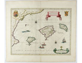
Location: 1644
Published: Amsterdam, 1644
Size: 380 x 497mm.
Color: In attractive strong original colours.
Condition: Generally in very fine condition. French text to verso.
A map of Mallorca and Minorca and with Ibiza and Formentera, called the Pytuisae Islands, with the coastline from Barcelona t..
750€
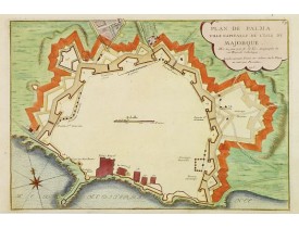
Location: 1715
Published: Paris, 1715
Size: 236 x 345mm.
Color: Coloured.
Condition: Paper slightly browned. Minor marginal water staining. Lighter foxing.
Bird's eye-view of Palma de Majorca. Wind rose in the lower left corner...
300€
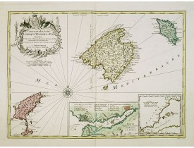
Location: 1720
Published: Amsterdam, 1720
Size: 405 x 560mm.
Color: In original colours.
Condition: Very good condition.
Fine map of the Baleares with much detail, in lower part inset "Plan du Port de Mahon du Fort St. Philippe et ses Fortificati..
1,200€
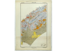
Location: 1920
Published: Paris, c. 1920
Size: 800 x 490mm.
Color: Colour printed.
Condition: A stereo topography, paper slightly age-toned as usual. Very good condition.
Geological map showing part of he island Mall orca Soller, including Palma. The map gives the following information's about F..
125€
Location: 1932
Published: Palma, 1932
Size: 535 x 595mm.
Color: Colour printed.
Condition: Good condition.
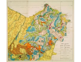
Geological map showing part of the island Mallorca Manacor, Son Severa, Capdepera.. After a design by D.Ferrá. Dibuxá, in low..
150€
Location: 1932
Published: Palma, 1932
Size: 610 x 520mm.
Color: Colour printed.
Condition: Good condition.
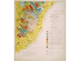
Geological map showing part of the island Mallorca Felanitx, Santanyi, Porto Cristo, Porto Colom.., including a legend with g..
100€
Showing 1 to 6 of 6 (1 Pages)

