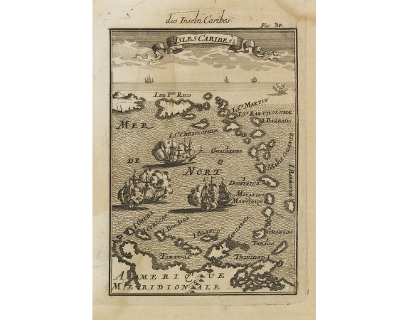
MALLET, A.M. - Isles Caribes.

MALLET, A.M. - Isles Caribes.
Published: Frankfurt, 1684
Size: 148 x 103mm.
Color: Uncoloured.
Condition: Heavy water staining on left half of engraved area.
Description
Very handsome map of the Caribbean, extending to include the shores of South America. The map is inserted in a prospective view of the Caribbean Sea, where some vessels are involved in a naval combat.
From the German text edition published by Davis Zunners.
Allain Manneson Mallet (1630-1706), a well traveled military engineer and geographer who worked in 17th century France under King Louis XIV.
From the German text edition published by Davis Zunners.
Allain Manneson Mallet (1630-1706), a well traveled military engineer and geographer who worked in 17th century France under King Louis XIV.
80€
- See other items by this publisher: MALLET, A.M.
- Reference N°: 30265
1923 views
 Click on image to zoom
