Lyonnais towns
The Silk Road extended approximately 6,437 kilometers (4,000 miles) across some of the world’s most formidable landscapes, including the Gobi Desert, the Pamir Mountains and traversed several of Uzbekistan’s major cities, including Samarkand, Bukhara and Khiva. The roads were typically in poor condition. Robbers were common. To protect themselves, traders joined together in caravans with camels or other pack animals. Over time, large inns called caravanserais cropped up to house travelling merchants.
One of the most famous travelers of the Silk Road was Marco Polo (1254 C.E. –1324 C.E.). Born into a family of wealthy merchants in Venice, Italy, Marco traveled with his father to China (then Cathay) when he was just 17 years of age.
It is hard to overstate the importance of the Silk Road on history. Religion and ideas spread along the Silk Road just as fluidly as goods. Towns along the route grew into multicultural cities.
The exchange of information gave rise to new technologies and innovations that would change the world.
The below antique maps are available for immediate sale, they are sold with a certificate of authenticity and published at the date indicated in the catalog description.
One of the most famous travelers of the Silk Road was Marco Polo (1254 C.E. –1324 C.E.). Born into a family of wealthy merchants in Venice, Italy, Marco traveled with his father to China (then Cathay) when he was just 17 years of age.
It is hard to overstate the importance of the Silk Road on history. Religion and ideas spread along the Silk Road just as fluidly as goods. Towns along the route grew into multicultural cities.
The exchange of information gave rise to new technologies and innovations that would change the world.
Antique maps including the Silk Route region
The below antique maps are available for immediate sale, they are sold with a certificate of authenticity and published at the date indicated in the catalog description.
Location: 1655
Published: Francfort/Main, 1655
Size: 190 x 285mm.
Color: Uncoloured.
Condition: Belle impression.
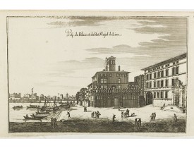
Planche figurant une vue du Palais (Maison de Roanne en bord de Saône détruite au XIXè siècle) et du Port Royal de Lyon, publ..
50€
Location: 1655
Published: Francfort am Main, 1655
Size: 237 x 310mm.
Color: Uncoloured.
Condition: Belle impression. Bonnes marges.
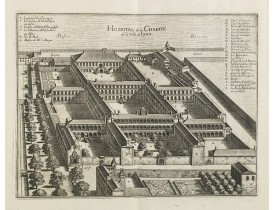
Vue de l'Hôpital de la Charité à Lyon, publiée dans la "Topographia Galliae"de Merian. De 1655 à 1661, Gaspard Merian édite e..
60€
Location: 1655
Published: Francfort/Main, 1655
Size: 165 x 250mm.
Color: Uncoloured.
Condition: Belle impression. Bonnes marges.
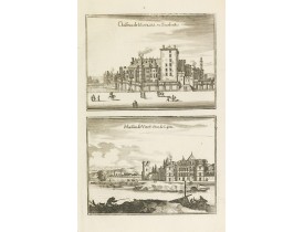
Planche figurant une vue du château de Moulins (Bourbonnais) et une vue de la Maison de Vimy (Neuville-sur-Saône), publiée da..
30€
Location: 1655
Published: Francfort/Main, 1655
Size: 192 x 293mm.
Color: Uncoloured.
Condition: Belle impression. Bonnes marges.
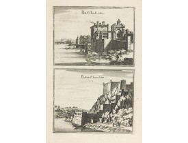
Planche figurant une vue de la Porte St. Clair de Lyon et une vue du Bastion de St Jean de Lyon (fort St-Jean) , publiée dans..
80€
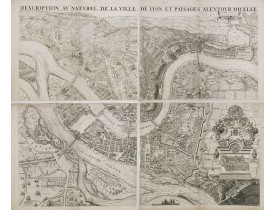
Location: 1659
Published: Lyon, 1659
Size: 780 x 953mm.
Color: Uncoloured.
Condition: Plan gravé sur cuivre en 4 feuilles non jointes. Petites fentes restaurées dans les marges, pâles rousseurs principalement dans les marges. Sans les bordures comprenant le texte.
PREMIERE EDITION. Plan de Lyon à « vol d’oiseau » commandé par le consulat, destiné à la diffusion et à la notoriété de la c..
2,500€
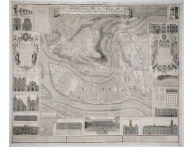
Location: 1740
Published: Lyon, ca. 1740
Size: 1130 x 1370 mm.
Color: Uncoloured.
Condition: On six joined sheets. Lower right hand corner teared off and reinstalled, missing parts partly redrawn. Small repaired hole in center. Generally in very good condition for a wall map of this size. dark impression.
GREGOIRE, R. P. - Plan Géometral de la Ville de Lyon. - 46531 - Lyonnais towns - GREGOIRE, R. P. - Plan Géometral de la Vill..
1,500€
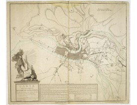
Location: 1793
Published: Paris, 1793
Size: 623 x 735mm.
Color: Uncoloured.
Condition: Papier légèrement bruni. Mouillure en haut et bas de carte, quelques déchirures en bordure de carte. Le Rhône est colorié en vert à l'époque.
Plan de Lyon dont le titre complet est le suivant : "Carte des environs de Commune-Affranchie, ou sont représentés les travau..
600€
Showing 1 to 7 of 7 (1 Pages)

