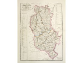
Lyonnais
The Silk Road extended approximately 6,437 kilometers (4,000 miles) across some of the world’s most formidable landscapes, including the Gobi Desert, the Pamir Mountains and traversed several of Uzbekistan’s major cities, including Samarkand, Bukhara and Khiva. The roads were typically in poor condition. Robbers were common. To protect themselves, traders joined together in caravans with camels or other pack animals. Over time, large inns called caravanserais cropped up to house travelling merchants.
One of the most famous travelers of the Silk Road was Marco Polo (1254 C.E. –1324 C.E.). Born into a family of wealthy merchants in Venice, Italy, Marco traveled with his father to China (then Cathay) when he was just 17 years of age.
It is hard to overstate the importance of the Silk Road on history. Religion and ideas spread along the Silk Road just as fluidly as goods. Towns along the route grew into multicultural cities.
The exchange of information gave rise to new technologies and innovations that would change the world.
The below antique maps are available for immediate sale, they are sold with a certificate of authenticity and published at the date indicated in the catalog description.
One of the most famous travelers of the Silk Road was Marco Polo (1254 C.E. –1324 C.E.). Born into a family of wealthy merchants in Venice, Italy, Marco traveled with his father to China (then Cathay) when he was just 17 years of age.
It is hard to overstate the importance of the Silk Road on history. Religion and ideas spread along the Silk Road just as fluidly as goods. Towns along the route grew into multicultural cities.
The exchange of information gave rise to new technologies and innovations that would change the world.
Antique maps including the Silk Route region
The below antique maps are available for immediate sale, they are sold with a certificate of authenticity and published at the date indicated in the catalog description.
Location: 1634
Published: Paris, 1634
Size: 370 x 510mm.
Color: In original o/l colours.
Condition: Paper contemporarily cut till plate mark and laid down on a larger sheet of paper. Good and dark impression. Excellent condition.
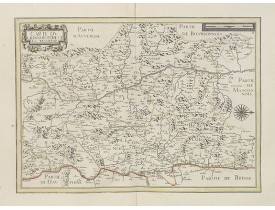
Very detailed map centered on Lyon and its northern surrounding area. Beautiful wind rose, showing west to the top.Nicolas Ta..
200€
Location: 1634
Published: Amsterdam, 1634
Size: 380 x 502mm.
Color: Uncoloured.
Condition: With wide margins. Strong and dark impression. Faint marginal water staining, two small repaired tears to lower margin. Else fine. German text on verso.
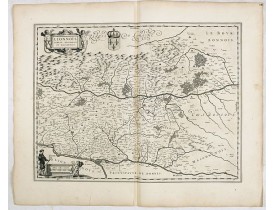
FIRST EDITION, FIRST ISSUE OF THIS MAP. From the 1634 edition of Blaeu's Atlas Novus, the first edition of this work.Map beau..
80€
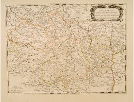
Location: 1644
Published: Amsterdam, 1644
Size: 380 x 502mm.
Color: In attractive original colours.
Condition: With wide margins. Strong and dark impression. Faint marginal water staining. Else fine.
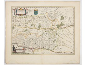
Map of a province of France including the rivers Loire and Rhone west of Lyon. Orientated with west at the top.Title cartouc..
200€
Location: 1650
Published: Paris, 1650
Size: 393 x 524mm.
Color: In original o/l colours.
Condition: Paper contemporarily cut till plate mark and laid down on a larger sheet of paper. Good and dark impression.
Fine map of central part of France. This edition carries the date 1650 and the cartouche presents the address of Pierre Marie..
100€
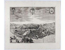
Location: 1700
Published: Amsterdam, ca. 1700
Size: 400 x 510mm.
Color: Uncolored
Condition: Très bel exemplaire sur papier fort. Impression bien contrastée. Grandes marges : 535 x 620 mm. Sans texte au verso. Infimes rousseurs. - A very fine copy on strong paper. A good and dark impression. Wide margins: 535 x 620 mm. Blank verso. Very slight foxing.
SCARCE bird's-eye view of Lyon. Adorned with a title cartouche at bottom left, a cartouche at bottom right containing the leg..
1,000€
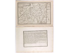
Location: 1705
Published: Paris, 1705
Size: 233 x 353mm.
Color: Uncoloured.
Condition: Mint condition. Dark impression. <br />Together with an engraved text sheet.
Map of central France with Clermont-Ferrand and Lyon to the right, from Nicolas de Fer's "L'Atlas curieux ou le Monde réprése..
50€
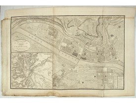
Location: 1826
Published: Lyon, Chez Vegezzy, M.d d'Estampes,1826
Size: 525 x 830mm.
Color: Uncolored
Condition: Plan replié en 3 volets et en partie supérieure. Sur papier fort. Mouillure en marge inférieure.
Grand plan de Lyon doté, en bas à gauche, d'un grand carton figurant "Les environs de Lyon, d'après Cassini" et en bas à dro..
400€
Location: 1841
Published: Paris, M. B. Dusillon, ca. 1841
Size: 675 x 480mm.
Color: In original o/l colors.
Condition: Paper slightly age toned but generally in very good condition. The maps on strong paper. Size of the sheet 560mm x 740mm.
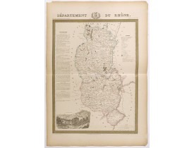
Detailed map of Rhône, from "Atlas général de France divisée en départements par Donnet et Monin ; avec armes et vues de Chap..
180€
Location: 1852
Published: Paris, A. Combette, 1852
Size: 420 x 280mm.
Color: In original o/l colours.
Condition: Tres bon état. Gravure sur acier avec limites en coloris d'époque, les éléments décoratifs ne sont pas coloriés.
Carte du département du Rhône. Jeune ingénieur géographe du milieu du XIXe siècle, Victor Levasseur est surtout connu pour so..
30€
Location: 875
Published: Paris, ca. 875
Size: 832 x 605mm.
Color: In original o/l colours.
Condition: Bel exemplaire sur papier fort.
Grande carte détaillée du département du Rhône, réduite d'après la grande carte de Cassini, et dressée par J B. Noellat. Grav..
150€
Showing 1 to 10 of 10 (1 Pages)


![LEVASSEUR, V. - Dépt. Du Rhône. N°68. [ Lyon ] LEVASSEUR, V. - Dépt. Du Rhône. N°68. [ Lyon ]](https://www.loeb-larocque.com/eshop/image/cache/catalog/image/new_upload/27147-275x210h.jpg)
