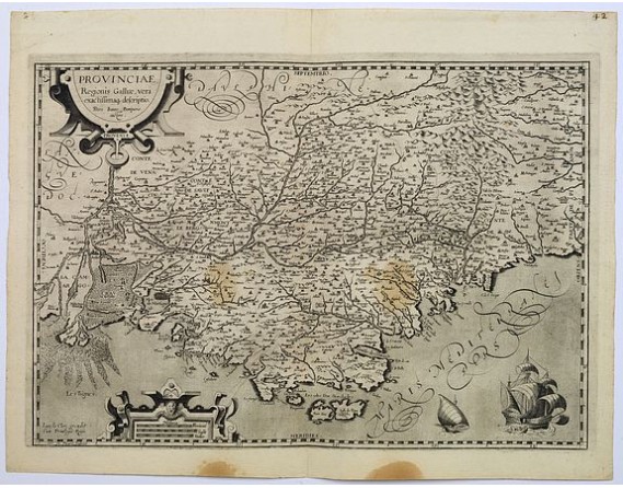
LE CLERC, J. - Provinciae, Regionis galliae, vera exactissimaq. Descriptio
 Click on image to zoom

LE CLERC, J. - Provinciae, Regionis galliae, vera exactissimaq. Descriptio
Published: Paris, ca. 1620
Size: 345 x 500mm.
Color: Uncoloured.
Condition: Some brown stains to the lower margin, otherwise in very good condition. Dark impression and good margins.
Description
This is a highly detailed and well engraved map of Provence in southern France. Engraved by H.Picart and published by Jean le Clerc.
Jean le Clerc (1560-1621) was an engraver, bookseller and publisher in Paris and Tours. He was a fourth generation bookseller and printer.
Le Clerc may have been associated with Maurice Bouguereau in the production of the "Theatre Geographique du Royaume de Francois" in 1594, but whether that was so or not, he subsequently used the plates to republish the Atlas in 1620 under a new title. In addition to the maps of France, the atlas included a World Map, originally engraved by Jodocus Hondius in 1608 copied from Mercator's twin hemisphere map of 1595.
He also issued in 1602 maps of Africa, America, Asia and Europe, engraved by Jodocus Hondius.
400€
- See other items by this publisher: LE CLERC, J.
- Reference N°: 38045
