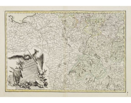
LATTRÉ / ZANNONI, R. - Carte de L'Empire D'Alemagne avec les Etats de Bohême..
 Click on image to zoom

LATTRÉ / ZANNONI, R. - Carte de L'Empire D'Alemagne avec les Etats de Bohême..
Published: Paris ca 1783
Size: 303 x 452mm.
Color: In attractive original body colours.
Condition: Minor marginal spots. Minor discolouration along centerfold. Printed on heavy paper, with good margins. Good impression.
Description
Attractive map centred on the south western part of Germany, including Switzerland, Luxembourg and part of Austria.
Decorative title cartouche with wine grapes, musical instruments and an eagle with two crowned heads. Boundaries outlined in hand colour.
Prepared by Giovanni Antonio Bartolomeo Rizzi Zannoni, one of the leading cartographers of the late 18th century, as well as being an astronomer, surveyor and mathematician.
Born in Padua, he worked in Venice and was engaged by the governments of Austria and France to produce maps.
Rizzi Zannoni was the first to execute the triangulation of Poland, assisting in the French and English border survey of American in 1757, and serving as the hydrographer of the Dépot de Marine.
He was also a member of the Cosmographic Society of Göttingen, a town in Saxony, Germany, home to the University of Göttingen.
Rizzi Zannoni is known for his world atlas, the French edition of which was published in 1762 as Atlas Moderne by Lattré in Bordeaux.
In 1781, he was invited by the Bourbon rulers of the Kingdom of Naples to direct the Topographical Office, among the first governmental cartographic agencies in Europe. There he produced celebrated land and maritime atlases of the region, as well as many separately issued maps.
75€
- Reference N°: 24264
