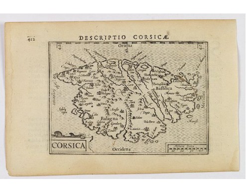
LANGENES, B. / BERTIUS, P. - Corsica.
 Click on image to zoom

LANGENES, B. / BERTIUS, P. - Corsica.
Published: Amsterdam, 1606
Size: 86 x 120mm.
Color: Uncoloured.
Condition: In excellent condition, lightly age toned, one ink mark. Wide margins, dark impression in the main. Latin text on verso.
Description
A fine miniature map of the French island of Corsica, published by Petrus Bertius in Amsterdam early in the seventeenth century. The map features a strap-work title cartouche, and a rectangular mileage scale in each of the lower corners.
The map has good topographical detail including; towns, hills and rivers. North is orientated to the left. Hatching in the sea.
Bertius (1565-1629) was a Flemish cartographer, theologian, historian and geographer. Although he published much in the fields of mathematics, theology and history, he is perhaps best known as a cartographer. This example is from his Tabularum Geographicarum Contractarum, and was heavily influenced by the earlier works of Mercator, from the late sixteenth century. He was connected, by marriage to Jacobus Hondius and Pieter van den Keere - both excellent cartographers, who would influence his later life.
Bertius was 'Cosmographer' to the court of King Louis XIII.
Read more about Caert Thresoor by Berent Langenes. [+]
300€
- Reference N°: 43170
