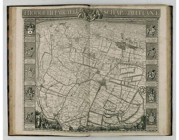
KRUIKIUS, N. / J. - 't Hooge Heemraedschap van Delfland met alle de Steden, Dorpen, Ambachten, Litmaten, Polders, (etc.).
 Click on image to zoom

KRUIKIUS, N. / J. - 't Hooge Heemraedschap van Delfland met alle de Steden, Dorpen, Ambachten, Litmaten, Polders, (etc.).
Published: Delft, 1712-1750
Size: 580 x 430mm.
Color: Uncoloured
Condition: Large-folio. Cont. mottled calf with raised bands, richly decorated. gilt back, gilt lettering 'Delfland' on both sides, surrounded by 2 gilt decorated. borders. Engraved title in 2 parts, engr. general map (2nd, altered edition, dated 1750) 25 numbered maps.
Description
The so-called Kruquius map is a wall-map of the Delfland water board district. The map consists of 25 engraved map sheets. Several maps flanked by fine large armorial cartouches. All sheets together cover a wall map with a total area of 230 x 280 cm. The map was often bound in a rich gilted calf binding and presented as gifts to important persons. The atlas than included also the overview map.
According to Prof. Koeman "Thanks to the quality of the cartography (a “sensitive” scale of 1:10,000 was used) rather than its size, the map surpasses all other water authority maps which were produced in the 17th and 18th centuries".
According to Prof. Koeman "Thanks to the quality of the cartography (a “sensitive” scale of 1:10,000 was used) rather than its size, the map surpasses all other water authority maps which were produced in the 17th and 18th centuries".
4,500€
- Reference N°: 45658
