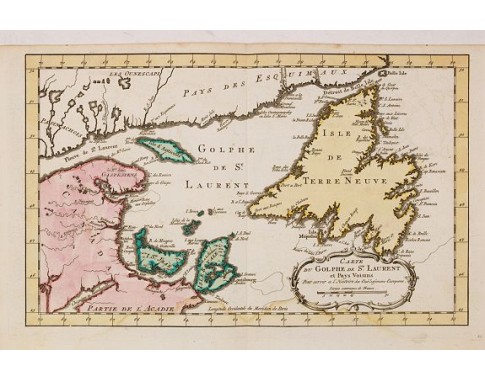
HARREVELT, E. van / CHANGUION, D.J. - Carte du Golphe de St.Laurent et Pays Voisins..
 Click on image to zoom

HARREVELT, E. van / CHANGUION, D.J. - Carte du Golphe de St.Laurent et Pays Voisins..
Published: Amsterdam, 1773
Size: 185 x 278mm.
Color: In attractive original o/l colours.
Condition: Pale water staining along lower margin, attaining the lower part of the map. Upper margin rather short as issued. Else good condition.
Description
Uncommon edition of this accurate map centered on the Gulf of St.Laurence. Second state. In lower right engraved "35."
From Atlas Portatif pour servir a l'intelligence de l'Histoire Philosophique et Politique des etablissements et du commerce des Européens dans les deux Indes.
Jacques Nicolas Bellin (1703-1772) was one of the most important and proficient French cartographers of the mid-eighteenth century. He was appointed the first Ingenieur Hydrographe de la Marine, and also Official Hydrographer to the French King.
Bellin produced a substantial number of important separately issued maps, particularly reflecting continuing discoveries and political events in the Americas.
RARE.
200€
- Reference N°: 23898
