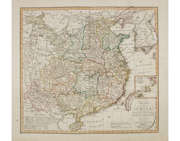
GEOGRAPH. INSTITUTS - Charte von China nach Murdochischer Projection entworfen. ... Berichtiget, und gezeichnet von H.F.A. Stieler. . .

GEOGRAPH. INSTITUTS - Charte von China nach Murdochischer Projection entworfen. ... Berichtiget, und gezeichnet von H.F.A. Stieler. . .
Published: Weimar, 1804
Size: 465 x 513mm.
Color: In attractive strong original colours.
Condition: Good impression on heavy paper and wide margins. Very good condition.
Description
Uncommon map of China prepared by H.F.A.Stieler, with parts of Taiwan, Tibet, Mongolia and the Korean peninsula, with a great many place names, a key to (and brief explanations of)municipal symbols, and a glossary of Chinese geographic terms.
The inset on the lower right edge of the map shows the "Lieu Kieu" islands between Japan and Taiwan, the source of the current territorial dispute between Japan and China.
The inset on the lower right edge of the map shows the "Lieu Kieu" islands between Japan and Taiwan, the source of the current territorial dispute between Japan and China.
800€
- Reference N°: 34224
2243 views
 Click on image to zoom
