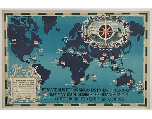
FRASER, E. - British Empire Trade Map WWII Eric Fraser.

FRASER, E. - British Empire Trade Map WWII Eric Fraser.
Published: England, 1941
Size: 505 x 760mm.
Color: In original lithographcolours.
Condition: Original lithograph poster. Restored folds, restored paper loss in bottom right corner, backed on linen. In good condition.
Description
Original vintage World War Two period British Empire trade map poster with the stylised text in Spanish reading: For more than two centuries the British fleets have kept the oceans safe for peaceful trade between nations / Durante más de dos siglos las flotas británicas han mantenido seguros los océanos para el comercio pacífico entre les naciones. Illustrated map design in shades of blue with a white anchor over the British Isles and the trading cities named and marked with British Empire flags, a decorative border around the text box below featuring mythical figures including a mermaid and fish with a man playing music and a nautical border around the compass point above with an historical tall ship in full sail on one side and a modern warship at sea on the other side.
2,000€
- Reference N°: 44941
3296 views
 Click on image to zoom
