Menu
Shop
Catalog
New
World maps - Celestials
World
0
Celestial charts
0
Poles
0
France
West regions
0
Anjou - Maine
0
Anjou - Maine towns
0
Aunis - Saintonge
0
Towns Aunis - Saintonge
0
Brittany
0
Brittany towns
0
Guyenne - Gascogne - Béarn
0
Guyenne-Gascogne towns
0
Normandy
0
Normandy towns
0
Poitou
0
Poitou towns
0
Vendée
0
Vendée towns
0
Central France
0
Berry
0
Limousin
0
Limousin towns
0
Nivernais
0
Orléanais
0
Orléanais towns
0
Touraine
0
Touraine towns
0
East regions
0
Alsace
0
Alsace towns
0
Auvergne
0
Auvergne towns
0
Bourgogne
0
Champagne - Ardennes
0
Champagne towns
0
Dauphiné
0
Dauphiné towns
0
Franche-Comté
0
Franche-Comté towns
0
Lorraine
0
Lorraine towns
0
Lyonnais
0
Lyonnais towns
0
Savoy
0
Savoy towns
0
South regions
0
Languedoc
0
Languedoc towns
0
Monaco
0
Provence
0
Provence towns
0
Roussillon
0
Corsica
0
Paris & Île-de-France
0
Île-de-France towns
0
Paris
0
Île-de-France
0
North regions
0
North
0
North towns
0
Picardy
0
Picardie towns
0
Nord
0
Nord towns
0
Europe
British Isles
0
England
0
Ireland
0
Scotland
0
Wales
0
Channel Islands
0
Gibraltar
0
Europe continent
0
Southern Europe
0
Greece
0
Portugal
0
Spain
0
Italy
0
Switzerland - Austria
0
Austria
0
Switzerland
0
Scandinavia
0
Scandinavia general
0
Denmark
0
Finland
0
Iceland
0
Norway
0
Sweden
0
BeNeLux
0
Belgium
0
Leo Belgicus maps
0
Luxemburg
0
Netherlands
0
Germany
0
Germany general
0
Germany provinces
0
Germany towns
0
Central & Eastern Europe
0
Balkans
0
Baltic Countries
0
Black Sea - Ukraine
0
Bulgaria
0
Czech Republic - Slovakia
0
Hungary
0
Lithuania
0
Poland
0
Romania
0
Russia
0
Mediterranean Sea
0
Balearic Islands
0
Cyprus
0
Malta
0
Minorca - Majorca
0
Sardinia
0
Sicily
0
Africa
Africa continent
0
North Africa
0
Algeria
0
Egypt
0
Libya
0
Morocco
0
Tunisia
0
West Africa
0
Central Africa
0
East Africa
0
East Africa general
0
Madagascar - Mauritius - La Réunion
0
South Africa
0
America
America continent
0
North America
0
North America general
0
Canada
0
Alaska
0
California
0
Florida
0
Great Lakes - Philadelphia
0
Indiana - Ohio - Kentuky
0
Mexico
0
Mississippi - Louisiana
0
New England
0
New England States
0
Virginia - Maryland - Carolina
0
Western America - Texas
0
Central America
0
Costa Rica
0
Guatemala
0
Honduras
0
Panama
0
Porto Rico
0
South America
0
Peru
0
South America general
0
Strait of Magellan - Tierra del Fuego
0
Venezuela
0
South America general
0
Argentina
0
Bolivia
0
Brazil
0
Chili
0
Colombia
0
French Guiana - Suriname
0
Paraguay
0
West Indies
0
Jamaica
0
Martinique
0
Trinidad and Tobago
0
West Indies general
0
Bermuda
0
Cuba
0
Curaçao
0
Guadeloupe
0
Haïti - Domenican Republique
0
Atlantic Ocean
0
Pacific
0
Asia
Asia continent
0
Central Asia
0
Silk Road
0
Usbekistan - Kazakhstan
0
Far East
0
China
0
China provinces
0
China towns
0
Hong Kong
0
Japan
0
Korea
0
Taiwan
0
Tartary - Mongolia
0
Tibet
0
Near and Middle East
0
Near & Middle East general
0
Arabian Peninsular
0
Holy Land
0
Libyan
0
Pakistan - Afghanistan
0
Persia/Iran
0
Syria
0
Turkey
0
India
0
Ceylon
0
Pakistan
0
South East Asia
0
Cambodia - Laos - Thailand - Vietnam
0
Indonesia
0
Malaysia - Singapore
0
Philippines
0
Oceania
Australia
0
French Polynesia
0
New Caledonia
0
New Zealand
0
Old Books - Atlases
Atlases
0
Cosmography
0
Local French history
0
Modern illustrated
0
Travel
0
Asian travel books
0
Travel America
0
Travel Americana
0
Travel Asia - Oceania
0
Travel Europe
0
Travel Africa
0
Various subjects
0
Architecture
0
Bibliography
0
Children books
0
Economy
0
Fashion & costume
0
Gastronomy
0
History
0
Judaica
0
Literature
0
Medicine
0
Military
0
Natural history
0
Science & technology
0
Sports
0
Typography
0
Various subjects
0
Prints
Architectural prints
0
Botanical Prints
0
Fashion prints
0
Japanese prints
0
Maritime
0
Natural history prints
0
Nuremberg Chronicle
0
Old Master
0
Optical prints
0
Other subject
0
Zoological prints
0
16th - 18th century prints
0
Wood block prints
0
19th century prints
0
20th century prints
0
Portraits
0
Various
Cartographic Curiosities
0
Carte-à-figures maps
0
Folding maps
0
Geological maps
0
Sea Charts
0
Title pages
0
Drawings
0
Erotica
0
Globes & Instruments
0
La Belle Époque
0
Medieval manuscript leaves
0
Photography
0
Posters & Publicity
0
Les Maitres de l'Affiche
0
Posters
0
Publicity
0
Prints
0
Architectural prints
0
Botanical Prints
0
Fashion prints
0
Japanese prints
0
Maritime
0
Natural history prints
0
Nuremberg Chronicle
0
Old Master
0
Optical prints
0
Other subject
0
Zoological prints
0
16th - 18th century prints
0
Wood block prints
0
19th century prints
0
20th century prints
0
Portraits
0
Valuation
Contact
Menu
Filter
Clear
Your Cart
Librairie Loeb-Larocque - Paris
Facebook
Instagram
Printerest
English
Français
English
€
Euro
EUR
€
Euro
EUR
£
Pound Sterling
GBP
$
US Dollar
USD
Search here...
Account
Login / Register
Login
Register
Wishlist
Edit Your Wishlist
0
Compare
Product Comparison
0
0 item(s) - 0€
0
Your shopping cart is empty!
Menu
Maps France
General France
North regions
North
Picardy
Paris & Île-de-France
Île-de-France
Île-de-France towns
Paris
West regions
Anjou - Maine
Aunis - Saintonge
Brittany
Guyenne - Gascogne - Béarn
Normandy
Poitou
Vendée
Central regions
Berry
Limousin
Nivernais
Orléanais
Touraine
East regions
Alsace
Auvergne
Bourgogne
Champagne - Ardennes
Dauphiné
Franche-Comté
Lorraine
Lyonnais
Savoy
South regions
Languedoc
Monaco
Provence
Roussillon
Corsica
Monaco
Maps all parts
World - Celestials - Poles
World
Celestial
Poles
Europe
Continent
British Isles
England
0
Ireland
0
Scotland
0
Wales
0
Channel Islands
0
Gibraltar
0
Switzerland - Austria
Austria
0
Switzerland
0
BeNeLux
Belgium
0
Leo Belgicus maps
0
Luxemburg
0
Netherlands
0
Germany
Germany general
0
Germany provinces
0
Germany towns
0
Central & Eastern Europe
Balkans
0
Baltic Countries
0
Black Sea - Ukraine
0
Bulgaria
0
Czech Republic - Slovakia
0
Hungary
0
Lithuania
0
Poland
0
Romania
0
Russia
0
Southern Europe
Greece
0
Portugal
0
Spain
0
Italy
0
Mediterranean
Balearic Islands
0
Cyprus
0
Malta
0
Minorca - Majorca
0
Sardinia
0
Sicily
0
Scandinavia
Scandinavia general
0
Denmark
0
Finland
0
Iceland
0
Norway
0
Sweden
0
Travel
Africa
African continent
North Africa
Algeria
0
Egypt
0
Libya
0
Morocco
0
Tunisia
0
Central Africa
West Africa
East Africa
East Africa general
0
Madagascar - Mauritius - La Réunion
0
South Africa
America
America continent
0
North America
0
North America general
0
Canada
0
Alaska
0
California
0
Florida
0
Great Lakes - Philadelphia
0
Indiana - Ohio - Kentuky
0
Mexico
0
Mississippi - Louisiana
0
New England
0
New England States
0
Virginia - Maryland - Carolina
0
Western America - Texas
0
Central America
0
Costa Rica
0
Guatemala
0
Honduras
0
Panama
0
Porto Rico
0
South America
0
Peru
0
South America general
0
Strait of Magellan - Tierra del Fuego
0
Venezuela
0
South America general
0
Argentina
0
Bolivia
0
Brazil
0
Chili
0
Colombia
0
French Guiana - Suriname
0
Paraguay
0
West Indies
0
Jamaica
0
Martinique
0
Trinidad and Tobago
0
West Indies general
0
Bermuda
0
Cuba
0
Curaçao
0
Guadeloupe
0
Haïti - Domenican Republique
0
Atlantic Ocean
0
Pacific
0
Asia
Asia continent
Near & Middle East
Near & Middle East general
0
Arabian Peninsular
0
Holy Land
0
Libyan
0
Pakistan - Afghanistan
0
Persia/Iran
0
Syria
0
Turkey
0
South East Asia
Cambodia - Laos - Thailand - Vietnam
0
Indonesia
0
Malaysia - Singapore
0
Philippines
0
India
Ceylon
0
Pakistan
0
Far East
China
0
China provinces
0
China towns
0
Hong Kong
0
Japan
0
Korea
0
Taiwan
0
Tartary - Mongolia
0
Tibet
0
Travel Asia & Oceania
Central Asia
Silk Road
0
Usbekistan - Kazakhstan
0
Oceania
Australia
New Zealand
Pacific
French Polynesia
Cartographic curiosities
Curiosities
Title pages
Globes
Carte-à-figures maps
Sea charts
Sea charts
Books
Atlases
Travel
Asie - Oceania
Travel America
Travel Europe
Travel Africa
Local French
Books Old & Rare
Fashion
Literature
Natural history
Modern illustrated
Reference books
Various
Fashion & costumes
Literature
Natural history
Various subjects
Varia
Posters / Les Maitres de l'Affiche
Posters
Les Maitres de l'Affiche
Prints
16th - 18th century
19th century
20th century
Architecture
Erotica
Fashion
Japanese prints
Natural history
Maritime
Portraits
Optical prints
Wood block prints
Zoological prints
Other subjects
Drawings
Posters & Publicity
Les Maitres de l'Affiche
0
Posters
0
Publicity
0
Cartographic curiosities
Carte-à-figures maps
Globes & Instruments
Leo Belgicus
Title Pages
Globes & instruments
Books of Hours & leaves
Erotica
Photography
The shop
About
Catalog
We Buy
Terms
Mapmakers
Schedel
Dating maps
Corsica Illustrata
News Letter
Contact
The Silk Road
Valuation
Next Auction
Next Auction
Results
Valuation
Estimation form
Contact
Valuation
Estimate your book
We buy
Valuation
Contact
Valuation form
Auction results
Contact
Contact
News Letter
Login
0
home
France
East regions
Franche-Comté
Franche-Comté
Franche-Comté towns
3
Product Compare
0
Sort By:
Default
Name (A - Z)
Name (Z - A)
Price (Low > High)
Price (High > Low)
Show:
24
25
50
75
100
Location:
1644
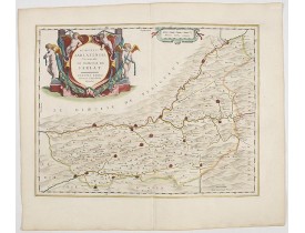
BLAEU, W. - Dioecesis Sarlatensis, vernacule..Sarlat.
Published
: Amsterdam, 1644
Size
: 382 x 490mm.
Color
: In attractive original colours.
Condition
: With wide margins. Mint.
Impressive title cartouche with four putti. Detailed ma[p of the region south of the Dordogne River from Bergerac till Saint-..
300€
BLAEU, W. - Dioecesis Sarlatensis, vernacule..Sarlat.
Add to Cart
Add to Wish List
Compare this Product
Ask Question
Ask Question
Location:
1668
DU VAL, P. - Le Comte de Bourgogne dit autrement Franche-Comte . . .
Published
: Paris, 1668
Size
: 380 x 522mm.
Color
: In original o/l colours.
Condition
: Very light water stain in lower right hand part of the map with very light foxing of paper. Good and dark impression.
Detailed map of Franche- Comté with fine title cartouche lower right. Centered on Besançon...
300€
DU VAL, P. - Le Comte de Bourgogne dit autrement Franche-Comte . . .
Add to Cart
Add to Wish List
Compare this Product
Ask Question
Ask Question
Location:
1749
ROBERT DE VAUGONDY, G. - Partie méridionale du comté de Bourgogne ou Franche-Comté. . .
Published
: Paris, 1749
Size
: 470 x 560mm.
Color
: In original o/l colours.
Condition
: Larges mouillures dans les angles supérieurs.
Carte détaillée de la partie méridionale de la Franche-Comté figurant les villes de Dôle, St Claude et le lac de Genève...
50€
ROBERT DE VAUGONDY, G. - Partie méridionale du comté de Bourgogne ou Franche-Comté. . .
Add to Cart
Add to Wish List
Compare this Product
Ask Question
Ask Question
Location:
1749
ROBERT DE VAUGONDY, G. - Partie septentrionale du comté de Bourgogne ou Franche-Comté. . .
Published
: Paris, 1749
Size
: 465 x 560mm.
Color
: In original o/l colours.
Condition
: Larges mouillures dans les angles supérieurs.
Carte détaillée de la Franche-Comté figurant les villes de Vesoul, Besançon, Auxonne, Gray, et Belfort...
40€
ROBERT DE VAUGONDY, G. - Partie septentrionale du comté de Bourgogne ou Franche-Comté. . .
Add to Cart
Add to Wish List
Compare this Product
Ask Question
Ask Question
Location:
1806
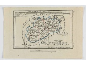
DELAPORTE,L'Abbé. - Carte du Département de la Haute Saône.
Published
: Paris, Prudhomme, Levrault, Debray, 1806
Size
: 96 x 150mm.
Color
: In original o/l colours.
Condition
: Belle impression. Marge supérieure courte.
Carte centrée sur la ville de Vesoul, avec une petite légende dans le coin supérieur gauche.@..
15€
DELAPORTE,L'Abbé. - Carte du Département de la Haute Saône.
Add to Cart
Add to Wish List
Compare this Product
Ask Question
Ask Question
Location:
1806
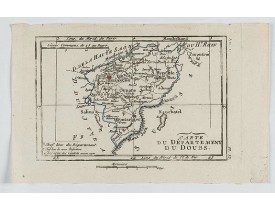
DELAPORTE, L'Abbé. - Carte du Département du Doubs.
Published
: Paris, Prudhomme, Levrault, Debray, 1806
Size
: 98 x 151 mm.
Color
: In original o/l colours.
Condition
: Belle impression. Marge supérieure courte.
DELAPORTE, L'Abbé. - Carte du Département du Doubs. - 62282 - Franche-Comté - DELAPORTE, L'Abbé. - Carte du Département du D..
20€
DELAPORTE, L'Abbé. - Carte du Département du Doubs.
Add to Cart
Add to Wish List
Compare this Product
Ask Question
Ask Question
Location:
1841
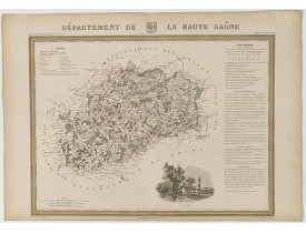
DONNET and MONIN. - Département de la Haute Saône.
Published
: Paris, M. B. Dusillon, ca. 1841
Size
: 480 x 675mm.
Color
: In original o/l colors.
Condition
: Paper slightly age toned but generally in very good condition. The maps on strong paper. Size of the sheet 560mm x 740mm.
Detailed map of Haute Saône from "Atlas général de France divisée en départements par Donnet et Monin ; avec armes et vues de..
150€
DONNET and MONIN. - Département de la Haute Saône.
Add to Cart
Add to Wish List
Compare this Product
Ask Question
Ask Question
Location:
1841
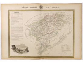
DONNET and MONIN. - Département de Doubs.
Published
: Paris, M. B. Dusillon, ca. 1841
Size
: 480 x 675mm.
Color
: In original o/l colors.
Condition
: Paper slightly age toned but generally in very good condition. The maps on strong paper. Size of the sheet 560mm x 740mm.
Detailed map of Doubs from "Atlas général de France divisée en départements par Donnet et Monin ; avec armes et vues de Chapu..
150€
DONNET and MONIN. - Département de Doubs.
Add to Cart
Add to Wish List
Compare this Product
Ask Question
Ask Question
Location:
1841
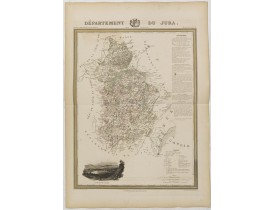
DONNET and MONIN. - Département du Jura.
Published
: Paris, M. B. Dusillon, ca. 1841
Size
: 675 x 480mm.
Color
: In original o/l colors.
Condition
: Paper slightly age toned but generally in very good condition. The maps on strong paper. Size of the sheet 560mm x 740mm.
Map of the Jura department published in "Atlas Général de France", divided into departments by Donnet and Monin, geographers,..
150€
DONNET and MONIN. - Département du Jura.
Add to Cart
Add to Wish List
Compare this Product
Ask Question
Ask Question
Location:
1852
LEVASSEUR, V. - Dépt. De La Hte. Saône. N°69. [ Vesoul ]
Published
: Paris, A. Combette, 1852
Size
: 420 x 280mm.
Color
: In original o/l colours.
Condition
: Tres bon état. Gravure sur acier avec limites en coloris d'époque, les éléments décoratifs ne sont pas coloriés.
Carte du département de la Haute Saône. Jeune ingénieur géographe du milieu du XIXe siècle, Victor Levasseur est surtout conn..
30€
LEVASSEUR, V. - Dépt. De La Hte. Saône. N°69. [ Vesoul ]
Add to Cart
Add to Wish List
Compare this Product
Ask Question
Ask Question
Location:
1858
PETRI Girolamo - Province ecclesiastica di Besançon in Francia (Tav LVI)
Published
: Rome, 1858
Size
: 500 x 570mm.
Color
: In attractive original wash colours.
Condition
: With original full hand colour, on fine wove paper watermarked ‘Pietro Miliani Fabriano’, size of the sheet 570 x 800 mm.
This large-format Besançon map is finely engraved and beautifully coloured and was prepared by Girolamo Petri, a lawyer who..
250€
PETRI Girolamo - Province ecclesiastica di Besançon in Francia (Tav LVI)
Add to Cart
Add to Wish List
Compare this Product
Ask Question
Ask Question
Location:
1873
FOURNIER, Louis. - Nouvelle Carte des départements du Doubs, du Jura, et de la Haute Saône, formant, avant 1790, l'ancienne province de la Franche-Comté.
Published
: Besançon, 1873
Size
: 830 x 1270mm.
Color
: In original o/l colours.
Condition
: Carte en 2 feuilles non jointes. Bel exemplaire.
Grande carte de Franche-Comté dressée d'après les cartes de l'Etat-Major par Louis Fournier, Employé des Ponts-et-Chaussées, ..
200€
FOURNIER, Louis. - Nouvelle Carte des départements du Doubs, du Jura, et de la Haute Saône, formant, avant 1790, l'ancienne province de la Franche-Comté.
Add to Cart
Add to Wish List
Compare this Product
Ask Question
Ask Question
Showing 1 to 12 of 12 (1 Pages)
Filter Products