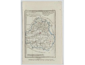
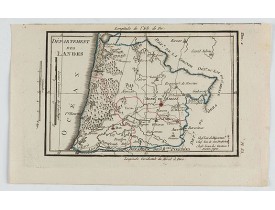
Guyenne - Gascogne - Béarn
The Silk Road extended approximately 6,437 kilometers (4,000 miles) across some of the world’s most formidable landscapes, including the Gobi Desert, the Pamir Mountains and traversed several of Uzbekistan’s major cities, including Samarkand, Bukhara and Khiva. The roads were typically in poor condition. Robbers were common. To protect themselves, traders joined together in caravans with camels or other pack animals. Over time, large inns called caravanserais cropped up to house travelling merchants.
One of the most famous travelers of the Silk Road was Marco Polo (1254 C.E. –1324 C.E.). Born into a family of wealthy merchants in Venice, Italy, Marco traveled with his father to China (then Cathay) when he was just 17 years of age.
It is hard to overstate the importance of the Silk Road on history. Religion and ideas spread along the Silk Road just as fluidly as goods. Towns along the route grew into multicultural cities.
The exchange of information gave rise to new technologies and innovations that would change the world.
The below antique maps are available for immediate sale, they are sold with a certificate of authenticity and published at the date indicated in the catalog description.
One of the most famous travelers of the Silk Road was Marco Polo (1254 C.E. –1324 C.E.). Born into a family of wealthy merchants in Venice, Italy, Marco traveled with his father to China (then Cathay) when he was just 17 years of age.
It is hard to overstate the importance of the Silk Road on history. Religion and ideas spread along the Silk Road just as fluidly as goods. Towns along the route grew into multicultural cities.
The exchange of information gave rise to new technologies and innovations that would change the world.
Antique maps including the Silk Route region
The below antique maps are available for immediate sale, they are sold with a certificate of authenticity and published at the date indicated in the catalog description.
Location: 1618
Published: Amsterdam 1616-1618
Size: 95 x 135mm.
Color: Uncoloured.
Condition: Good condition. Paper slightly age-toned.
Text in latin on verso...
150€
Location: 1618
Published: Amsterdam 1616-1618
Size: 95 x 135mm.
Color: Uncoloured.
Condition: Good condition. Paper slightly age-toned.
Text in latin on verso...
150€
Location: 1638
Published: Paris, ca. 1638
Size: 403 x 550mm.
Color: In original o/l colours.
Condition: Bas de planche replié à l'origine. Bel exemplaire.
Very rare map including Bayonne and Dax in the south west of France. With inset plan of "Plan de la ville Dax.". With the add..
800€
Location: 1638
Published: Paris, 1638
Size: 395 x 525 mm.
Color: Original colours
Condition: Added margins on the verticals right and left sides. Browned paper. Fair condition.
DE LA POINTE, F. - Carte du Siège Présidial Dax… - 45048 - Guyenne - Gascogne - Béarn - DE LA POINTE, F. - Carte du Siège Pr..
800€
Location: 1638
Published: Paris, 1638
Size: 403 x 550mm.
Color: In attactive original colours.
Condition: Bel exemplaire.
Rare carte figurant les régions de Dax et Bayonne publiée dans le "Theatre des Gaules" de Boisseau en 1642, "A la Fontaine d..
1,500€
Location: 1644
Published: Amsterdam, 1644
Size: 391 x 536mm.
Color: In attractive original colours.
Condition: Some light creasing along center fold. Very good and dark impression. French text on verso.
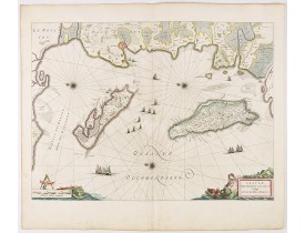
Map of Ré and Oléron islands. Depicting the west coast of France, showing La Rochelle. Several vessels and sailing ships dot ..
750€
Location: 1650
Published: Amsterdam, 1650
Size: 385 x 519mm.
Color: Original body colours.
Condition: Fine. With wide margins. Paper slightly browned, as usual. Several town spots heightened in gold.
¤..
750€
Location: 1656
Published: Amsterdam, 1656
Size: 439 x 540mm.
Color: In original colours.
Condition: Fine. With wide margins. Paper slightly browned, as usual. Several town spots heightened in gold.
Decorative map of southwestern France, showing Mont-de-Marsan and Roquefort.This region is well known for its cheeses, althou..
250€
Location: 1656
Published: Amsterdam, 1656
Size: 360 x 489mm.
Color: In original o/l colours.
Condition: Generally in good condition. Paper slightly browned, as usual.
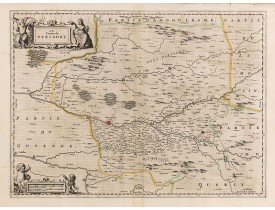
Detailled map of the Perigord. Map is centered on Bergerac. Map shows the city of Biron, Sarlat, Perigueux, Mucidan....
200€
Location: 1666
Published: Paris, Iacques Iollain, 1666
Size: 353 x 465mm.
Color: Uncoloured.
Condition: Trace de pli dans la partie gauche. Pâles taches brunes au centre. Petits dessins à la plume en marge.
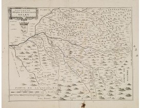
Rare carte du Béarn par le Sieur Sollon la Fitte Bearnois, M. D. S. E; publiée chez Iacques Iollain sur le quay de la Megisse..
500€
Location: 1666
Published: Amsterdam, 1666
Size: 445 x 544mm.
Color: Coloured.
Condition: On double-ply paper as issued. Paper very mildly age-toned, as usual. A good and dark impression.
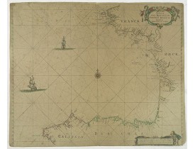
An eye-catching chart of the coast of Bretagne from Brest running south till the coast of Biscay in Northern Spain.Pieter Goo..
600€
Location: 1692
Published: Venice, 1692
Size: 600 x 452mm.
Color: Uncoloured
Condition: A very good and dark impression. Some very minor age-toning along centerfold. Very good condition.
A most attractive and decorative map by Vincenzo Coronelli. An elaborate title cartouche garlanded with intertwined flowers a..
500€
Location: 1695
Published: Paris, 1695
Size: 220 x 320mm.
Color: Uncoloured.
Condition:
Detailled map of the region of Bordeaux. Showing in detail the estuary of Gironde...
150€
Location: 1711
Published: Paris, 1711
Size: 469 x 704mm.
Color: In original o/l colours.
Condition: In good condition.
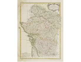
Showing Poitou, Pays d'Aunis, Saintonge, Limousin, Medoc, Perigord, etc. Embellished with a big title cartouche surrounded by..
200€
Location: 1745
Published: Amsterdam, ca 1745
Size: 480 x 590mm.
Color: Uncoloured.
Condition: Dark impression printed on stout paper, slightly age-toned. Brown spots on left and upper left margins, not attaining the engraved area. Else very good condition.
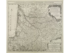
Detailed map of the Guyenne and Gascony region in southwest France. Covers the region from the mouth of the Garonne River to ..
220€
Location: 1756
Published: Paris, 1756
Size: 277 x 205mm.
Color: In original o/l colours.
Condition: Paper very slightly age-toned. A good impression. Short right margin, as issued. Some minor offsetting of paint. Repair of split in upper part centerfold, 3 cm into the engraved area.
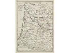
Fine map of the French provinces of Guyenne and Gascogne. George Louis Le Rouge was active from 1740- till 1780 as a publishe..
80€
Location: 1783
Published: Paris ca 1783
Size: 407 x 308 mm.
Color: In attractive original body colours.
Condition: Water staining along left margin, affecting the left corners of the map. Printed on heavy paper, with good margins. Good impression.
LATTRÉ, J. / BONNE, R. - Carte des Gouvernements d' Anjou et du Saumurois.. Saintonge-Angoumois.. - 24225 - Guyenne - Gascog..
60€
Location: 1784
Published: Paris, 1784
Size: 518 x 635mm.
Color: Uncoloured.
Condition: Mounted on linen, dissected in 15 parts, lined with green silk. Some age toning of paper.
Very rare and beautiful plan of the city and bay of Saint-Jean-de-Luz, detailing the projects of expansion of the port undert..
2,000€
Location: 1784
Published: Venice, 1777 - 1784
Size: 575 x 430mm.
Color: Original outline colours.
Condition: Very good condition. Printed on heavy paper.
Attractive map of the south western part of France, covering the area south of the river Gironde until the Spanish border. Th..
400€
Location: 1784
Published: Venise, 1777 - 1784
Size: 575 x 430mm.
Color: In original o/l colours.
Condition: Bel exemplaire sur papier fort. - Very good condition.
Carte par R. Bonne publiée dans l'édition vénitienne de l"Atlas Universel" de Gilles Didier Robert de Vaugondy, édité en 1776..
100€
Location: 1792
Published: Siena, 1792
Size: 305 x 230mm.
Color: In original colours.
Condition: Quelques taches dans la marge droite. Bonne condition générale. Bonnes marges. Bel exemplaire aquarellé à l’époque.
Carte décrivant les régions du Périgord, de la Guienne et de Gascogne et du Béarn gravée par Carli Pazzini .Rare regional ma..
150€
Location: 1806
Published: Paris, Prudhomme, Levrault, Debray, 1806
Size: 150 x 96 mm.
Color: In original o/l colours.
Condition: Belle impression. Marge gauche courte. Infimes rousseurs.
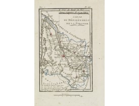
DELAPORTE, L'Abbé. - Carte du Département de la Gironde. - 62255 - Guyenne - Gascogne - Béarn - DELAPORTE, L'Abbé. - Carte du..
30€
Location: 1806
Published: Paris, Prudhomme, Levrault, Debray, 1806
Size: 150 x 99 mm.
Color: In original o/l colours.
Condition: Belle impression. Marge gauche courte avec une infime mouillure.
DELAPORTE, L'Abbé. - Carte du Département de la Dordogne. - 62262 - Guyenne - Gascogne - Béarn - DELAPORTE, L'Abbé. - Carte ..
20€
Location: 1806
Published: Paris, Prudhomme, Levrault, Debray, 1806
Size: 99 x 150 mm.
Color: In original o/l colours.
Condition: Belle impression. Marge supérieure courte.
DELAPORTE, L'Abbé. - Carte du Département des Landes. - 62248 - Guyenne - Gascogne - Béarn - DELAPORTE, L'Abbé. - Carte du D..
20€


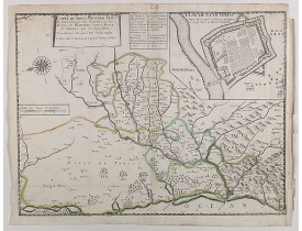
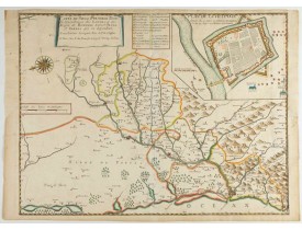




![DE FER, N. - [Saintonge, Guienne, Medoc.] DE FER, N. - [Saintonge, Guienne, Medoc.]](https://www.loeb-larocque.com/eshop/image/cache/catalog/image/new_upload/31394-275x210h.jpg)

