Alsace
The Silk Road extended approximately 6,437 kilometers (4,000 miles) across some of the world’s most formidable landscapes, including the Gobi Desert, the Pamir Mountains and traversed several of Uzbekistan’s major cities, including Samarkand, Bukhara and Khiva. The roads were typically in poor condition. Robbers were common. To protect themselves, traders joined together in caravans with camels or other pack animals. Over time, large inns called caravanserais cropped up to house travelling merchants.
One of the most famous travelers of the Silk Road was Marco Polo (1254 C.E. –1324 C.E.). Born into a family of wealthy merchants in Venice, Italy, Marco traveled with his father to China (then Cathay) when he was just 17 years of age.
It is hard to overstate the importance of the Silk Road on history. Religion and ideas spread along the Silk Road just as fluidly as goods. Towns along the route grew into multicultural cities.
The exchange of information gave rise to new technologies and innovations that would change the world.
The below antique maps are available for immediate sale, they are sold with a certificate of authenticity and published at the date indicated in the catalog description.
One of the most famous travelers of the Silk Road was Marco Polo (1254 C.E. –1324 C.E.). Born into a family of wealthy merchants in Venice, Italy, Marco traveled with his father to China (then Cathay) when he was just 17 years of age.
It is hard to overstate the importance of the Silk Road on history. Religion and ideas spread along the Silk Road just as fluidly as goods. Towns along the route grew into multicultural cities.
The exchange of information gave rise to new technologies and innovations that would change the world.
Antique maps including the Silk Route region
The below antique maps are available for immediate sale, they are sold with a certificate of authenticity and published at the date indicated in the catalog description.
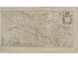
Location: 1634
Published: Amsterdam, 1634
Size: 395 x 790 mm.
Color: Uncoloured.
Condition: Good, paper lightly age toned, left hand margin tight, with some small tears and is creased but all intact. A small repaired tear to a the centerfold. German text on verso.
BLAEU, W. - Alsatia landgraviatus, cum Suntgoia et Brisgoia,. . . - 36085 - Alsace - BLAEU, W. - Alsatia landgraviatus, cum ..
200€
Location: 1705
Published: Paris, 1705
Size: 690 x 635mm.
Color: In original o/l colours.
Condition: Good condition.
Detailled map of Alsace, Lorraine and Souabe...
50€
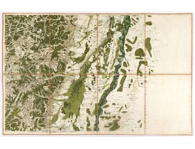
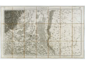
Location: 1750
Published: Paris, ca. 1750
Size: 565 x 900mm.
Color: In attactive original colours.
Condition: Carte dépliante divisée en 8 segments et montée sur toile.
Carte figurant la région de Colmar et de Sélestat et une portion du Rhin avec une partie du Brisgau. Cette carte, en très bea..
150€
Location: 1841
Published: Paris, M. B. Dusillon, ca. 1841
Size: 480 x 675mm.
Color: In original o/l colors.
Condition: Paper slightly age toned but generally in very good condition. The maps on strong paper. Size of the sheet 560mm x 740mm.
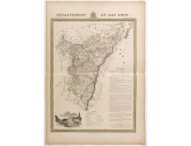
Detailed map of Bas Rhin, from "Atlas général de France divisée en départements par Donnet et Monin ; avec armes et vues de C..
180€
Location: 1841
Published: Paris, M. B. Dusillon, ca. 1841
Size: 675 x 480mm.
Color: In original o/l colors.
Condition: Paper slightly age toned but generally in very good condition. The maps on strong paper. Size of the sheet 560mm x 740mm.
Detailed map of Bas Rhin, from "Atlas général de France divisée en départements par Donnet et Monin ; avec armes et vues de C..
180€
Location: 1852
Published: Paris, A. Combette, 1852
Size: 275 x 415mm.
Color: In original o/l colours.
Condition: Tres bon état. Gravure sur acier avec limites en coloris d'époquer, les éléments décoratifs ne sont pas coloriés.
Carte du département du Bas Rhin. Jeune ingénieur géographe du milieu du XIXe siècle, Victor Levasseur est surtout connu pour..
30€
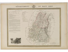
Location: 1852
Published: Paris, A. Combette, 1852
Size: 275 x 415mm.
Color: In original o/l colours.
Condition: Tres bon état. Gravure sur acier avec limites en coloris d'époquer, les éléments décoratifs ne sont pas coloriés.
Carte du département du Hauts Rhin. Jeune ingénieur géographe du milieu du XIXe siècle, Victor Levasseur est surtout connu po..
30€
Showing 1 to 8 of 8 (1 Pages)


![LEVASSEUR, V. - Dépt. Du Bas Rhin. N°66. [ Strasbourg ] LEVASSEUR, V. - Dépt. Du Bas Rhin. N°66. [ Strasbourg ]](https://www.loeb-larocque.com/eshop/image/cache/catalog/image/new_upload/27145-275x210w.jpg)
![LEVASSEUR, V. - Dépt. Du Haut Rhin. N°67. [ Colmar ] LEVASSEUR, V. - Dépt. Du Haut Rhin. N°67. [ Colmar ]](https://www.loeb-larocque.com/eshop/image/cache/catalog/image/new_upload/27146-275x210w.jpg)