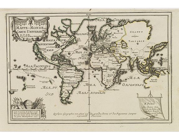
FER,N. De - Mappe-Monde ou carte Universelle..

FER,N. De - Mappe-Monde ou carte Universelle..
Published: Paris, 1705
Size: 226 x 338mm.
Color: In original o/l colours.
Condition: Wide margins. Good and dark impression.
Description
Uncommon world map in Mercator's projection, which first appeared in De Fer's Atlas Curieux.
Showing California as an island. Engraved by C.Inselin.
Shows the explorer's routes around the world and a host of other interesting features, including incomplete coastlines for New Zealand and Australia and a the NW Coast of America, hidden behind it's decorative title cartouche.
The map has an updated privilege to the King, "1705", another more common edition is known with the date 1702.
800€
- See other items by this publisher: FER,N. De
- Reference N°: 30280
3167 views
 Click on image to zoom
