China provinces
The Silk Road extended approximately 6,437 kilometers (4,000 miles) across some of the world’s most formidable landscapes, including the Gobi Desert, the Pamir Mountains and traversed several of Uzbekistan’s major cities, including Samarkand, Bukhara and Khiva. The roads were typically in poor condition. Robbers were common. To protect themselves, traders joined together in caravans with camels or other pack animals. Over time, large inns called caravanserais cropped up to house travelling merchants.
One of the most famous travelers of the Silk Road was Marco Polo (1254 C.E. –1324 C.E.). Born into a family of wealthy merchants in Venice, Italy, Marco traveled with his father to China (then Cathay) when he was just 17 years of age.
It is hard to overstate the importance of the Silk Road on history. Religion and ideas spread along the Silk Road just as fluidly as goods. Towns along the route grew into multicultural cities.
The exchange of information gave rise to new technologies and innovations that would change the world.
The below antique maps are available for immediate sale, they are sold with a certificate of authenticity and published at the date indicated in the catalog description.
One of the most famous travelers of the Silk Road was Marco Polo (1254 C.E. –1324 C.E.). Born into a family of wealthy merchants in Venice, Italy, Marco traveled with his father to China (then Cathay) when he was just 17 years of age.
It is hard to overstate the importance of the Silk Road on history. Religion and ideas spread along the Silk Road just as fluidly as goods. Towns along the route grew into multicultural cities.
The exchange of information gave rise to new technologies and innovations that would change the world.
Antique maps including the Silk Route region
The below antique maps are available for immediate sale, they are sold with a certificate of authenticity and published at the date indicated in the catalog description.
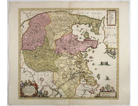
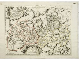
Location: 1660
Published: Amsterdam, ca 1660
Size: 467 x 524 mm.
Color: Coloured
Condition: Good and dark impression.
JANSSONIUS, J. - Pecheli, Xansi, Xantung, Honan, Nanking, In plaga Regni Sinensis.. - 38794 - China provinces - JANSSONIUS, ..
1,500€
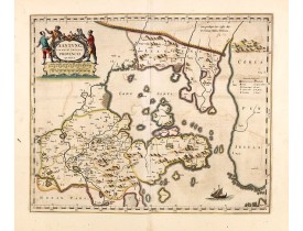
Location: 1660
Published: Amsterdam, ca 1660
Size: 396 x 480mm.
Color: In very attractive original colours.
Condition: Very good condition. Paper very slightly age-toned and some light offsetting due to oxidation of ink.
A map of the northern province ‘Xantung’ of China after the Jesuit Martino Martini.Shows the Great Wall and is centered on th..
1,400€
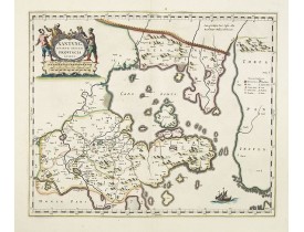
Location: 1660
Published: Amsterdam, ca 1660
Size: 396 x 480mm.
Color: In original colours.
Condition: Very good condition. Good and dark impression.
A map of the northern province ‘Xantung’ of China after the Jesuit Martino Martini.Shows the Great Wall and is centered on th..
1,200€
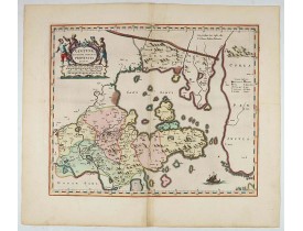
Location: 1660
Published: Amsterdam, ca 1660
Size: 396 x 480 mm.
Color: In very attractive original colours.
Condition: Very good to mint condition. Very hard to get in this type of rich contemporary colouring and cartouches with a few <b>gold highlights</b>.
BLAEU, J. - Xantung, sinarum imperii provincia quatra. - 34015 - China provinces - BLAEU, J. - Xantung, sinarum imperii prov..
2,000€
Location: 1690
Published: Venice, 1690
Size: 450 x 590mm.
Color: In original o/l colours.
Condition: Good and dark impression. Unusual to find a Coronelli map in original out line colours.
A beautiful map depicting the area of Beijing with decorative title cartouche and scale cartouche. Information about the area..
600€
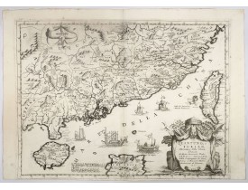
Location: 1691
Published: Venice, 1691
Size: 452 x 605mm.
Color: Uncoloured.
Condition: Short lower margin. A strong impression printed on thick paper. Italian description on verso.
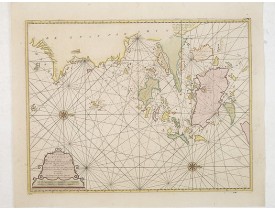
A beautifully engraved decorative map of Southern China extending from Hainan in the West to Formosa in the East and centered..
3,500€
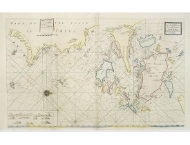
Location: 1734
Published: London, William Mount & Thomas Page, 1734
Size: 518 x 865mm.
Color: Coloured.
Condition: In very good condition.
A very fine sea chart of China's Zhejiang Province, from the celebrated Third Book of 'The English Pilot'This elegant and lar..
2,500€
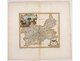
Location: 1735
Published: Paris, P.G. Le Mercier, 1735
Size: 371 x 435mm.
Color: Uncoloured.
Condition: A very good and dark impression. Wide margins.
Important map of Yun-nan 云南 [Yunnan] province. With a quite elaborately pictorial cartouche featuring a rococo chinoiserie or..
100€
Location: 1735
Published: Paris, P.G. Le Mercier, 1735
Size: 258 x 302mm.
Color: Coloured.
Condition: A very good and dark impression. Wide margins.
Important map of Koei-tcheou 贵州 [Guizhou]. With a quite elaborately pictorial cartouche featuring a rococo chinoiserie orname..
80€
Location: 1753
Published: Amsterdam, 1753
Size: 410 x 535mm.
Color: In original colours.
Condition: Paper slightly age-toned. Several wormholes filled in, hardly notable. Very good throughout.
A rare and finely engraved and detailed chart of China's Zhejiang Province. Very rare: only included in 6th volume (so-called..
4,500€
Location: 1827
Published: Brussels, 1825-1827
Size: 462 x 508mm.
Color: Original colours.
Condition: Lithography, in original colours. Paper very slightly age toned. Plano sheet. Spotted.
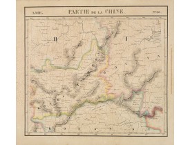
Covers Guizhou and parts of Yunnan, Guangxi, Hunan, Hubei and Sichuan.From his famous Atlas Universel . This atlas was one of..
150€
Location: 1827
Published: Brussels, 1825-1827
Size: 467 x 515mm.
Color: Original colours.
Condition: Lithography, in original colours. Paper very slightly age toned. Plano sheet.
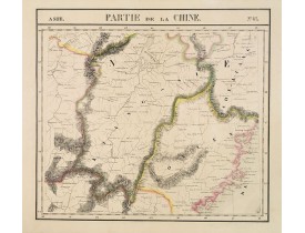
Covers Jiangxi, Fujian and parts of Zhejiang, Guangdong, Hunan and Hubei.From his famous Atlas Universel . This atlas was one..
150€
Location: 1874
Published: Paris, 1874
Size: 194 x 177mm.
Color: In original o/l colours.
Condition: Lithography in very good condition. Contemporarily pasted on a larger sheet.
Map of Tche Kiang, prepared by Bishop Edmond-François Guierry, C.M. (Vicar Apostolic of Zhejiang, China) after sources suppli..
100€
Location: 1874
Published: Lyon, c.1874
Size: 212 x 260mm.
Color: In original o/l colours.
Condition: Very good condition. Contemporarily pasted on a larger sheet.
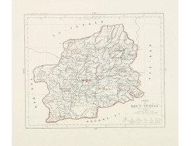
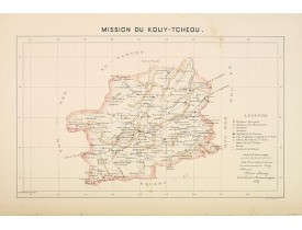
Detailed map of Guizhou Province prepared by Mgr. Faurie and other sources supplied by missionaries. Published in "Les Missio..
100€
Location: 1890
Published: Lille, 1890
Size: 265 x 415mm.
Color: In original printed colours.
Condition: Coloured lithography. Paper very slightly age toned. Accompanied by one page description of the region in French.
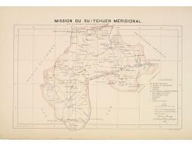
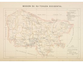
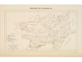
Important missionary map showing part of China, prepared by Adrien Launay, who was a French Missionary and later chronicer of..
50€
Location: 1890
Published: Lille, 1890
Size: 265 x 415mm.
Color: In original printed colours.
Condition: Coloured lithography. Paper very slightly age toned. Accompanied by one page description of the region in French.
Important missionary map showing part of China, prepared by Adrien Launay, who was a French Missionary and later chronicer of..
100€
Location: 1890
Published: Lille, 1890
Size: 265 x 415mm.
Color: In original printed colours.
Condition: Coloured lithography. Paper very slightly age toned. Accompanied by one page description of the region in French.
Important missionary map showing part of China, prepared by Adrien Launay, who was a French Missionary and later chronicer of..
100€
Location: 1890
Published: Lille, 1890
Size: 265 x 430mm.
Color: In original printed colours.
Condition: Coloured lithography. Paper very slightly age toned. Accompanied by one page description of the region in French.
Important missionary map showing part of China, prepared by Adrien Launay, who was a French Missionary and later chronicer of..
100€
Location: 1900
Published: Paris, 1900
Size: 470 x 586mm.
Color: In original o/l colours.
Condition: Helio engraving with printed colours.
Very detailed (1:1.000.000) map showing the area north of Nanjing, Jiangsu. The French Service géographique des armées was f..
400€
Showing 1 to 19 of 19 (1 Pages)


![GUIERRY, Mgr. - Carte du Tche-Kiang. [ Zhejiang province ] GUIERRY, Mgr. - Carte du Tche-Kiang. [ Zhejiang province ]](https://www.loeb-larocque.com/eshop/image/cache/catalog/image/new_upload/30921-275x210h.jpg)
![SERVICE GEOGRAPHIQUE DE L'ARMEE - Nankin [Nanjing, Jiangsu] SERVICE GEOGRAPHIQUE DE L'ARMEE - Nankin [Nanjing, Jiangsu]](https://www.loeb-larocque.com/eshop/image/cache/catalog/image/new_upload/30031-275x210h.jpg)