Czech Republic - Slovakia
The Silk Road extended approximately 6,437 kilometers (4,000 miles) across some of the world’s most formidable landscapes, including the Gobi Desert, the Pamir Mountains and traversed several of Uzbekistan’s major cities, including Samarkand, Bukhara and Khiva. The roads were typically in poor condition. Robbers were common. To protect themselves, traders joined together in caravans with camels or other pack animals. Over time, large inns called caravanserais cropped up to house travelling merchants.
One of the most famous travelers of the Silk Road was Marco Polo (1254 C.E. –1324 C.E.). Born into a family of wealthy merchants in Venice, Italy, Marco traveled with his father to China (then Cathay) when he was just 17 years of age.
It is hard to overstate the importance of the Silk Road on history. Religion and ideas spread along the Silk Road just as fluidly as goods. Towns along the route grew into multicultural cities.
The exchange of information gave rise to new technologies and innovations that would change the world.
The below antique maps are available for immediate sale, they are sold with a certificate of authenticity and published at the date indicated in the catalog description.
One of the most famous travelers of the Silk Road was Marco Polo (1254 C.E. –1324 C.E.). Born into a family of wealthy merchants in Venice, Italy, Marco traveled with his father to China (then Cathay) when he was just 17 years of age.
It is hard to overstate the importance of the Silk Road on history. Religion and ideas spread along the Silk Road just as fluidly as goods. Towns along the route grew into multicultural cities.
The exchange of information gave rise to new technologies and innovations that would change the world.
Antique maps including the Silk Route region
The below antique maps are available for immediate sale, they are sold with a certificate of authenticity and published at the date indicated in the catalog description.
Location: 1618
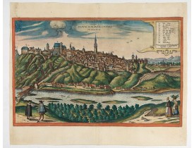
Published: Cologne, 1618
Size: 316 x 496mm.
Color: Colored
Condition: Extensive repair of left and right hand part of the print. Missing area redrawn. Attractive colors.
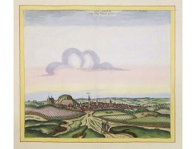
Rare bird's-eye view of Znojmo (Znaim) Key to 12 locations.COMMENTARY BY BRAUN: "This is a beautiful and wealthy city in Mora..
675€
Location: 1654
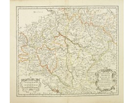
Published: Paris, 1654
Size: 377 x 482mm.
Color: In original o/l colours.
Condition: Good and dark impression. Little age-toned. Generally in very good condition. Tear repair on 10 cm in right part.
Covering Czech Republic and centred on Prague. This edition carries the date 1654.Nicolas Sanson was to bring about the rise ..
200€
Location: 1694
Published: Amsterdam, 1694
Size: 410 x 510mm.
Color: Noir et blanc
Condition: A very good and dark impression. Paper slightly browned. Repair of a split in upper part centerfold, 4cm. Into engraved area. Very good throughout.
A rare panoramic view of Prague with over the whole length of the lower part 3 columns of poems in Dutch, French, German and ..
2,000€
Location: 1696
Published: Venice, 1696
Size: 450 x 610mm.
Color: Uncoloured.
Condition: Very strong impression. Some very minor marginal spotting and light discolouration of center fold. In very good condition.
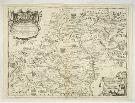
Although Komensky's map of Moravia was already known in his time, Coronelli used the obsolete map by Fabricius, with a lot of..
400€
Location: 1700
Published: The Hague, 1700
Size: 443 x 498mm.
Color: Original colours.
Condition: Contemporarily laid down on larger paper the engraved title from the original print almost invisibly integrated in the enlarged part.
The engraver and publisher of prints, Mrs. Anna Beek of the Hague, enlarged this print, originally published by Braun and Hog..
1,000€
Location: 1742
Published: Paris, ca. 1742
Size: 515 x 397mm.
Color: In original colours.
Condition: With some marginal tears, with foldings. Repair of a tear in right hand part, 11cm. Into engraved area. In very good condition for a separately published print.
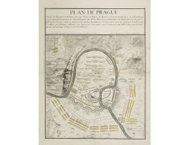
Rare and separately published plan of Prague published by Joan Baptista Nolin with the address à l'enseigne de la Place des ..
500€
Location: 1780
Published: Nuremberg, 1780
Size: 477 x 555mm.
Color: Limites col.
Condition: Mouillures. Rousseurs. Marges refaites. Some light discoloration along the center fold, with a light brown spot. Map cut on neatline and contemporarily added margins to fit in a composite atlas. A good and dark impression.
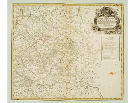
Detailed map of eastern Europe, including the towns of Berlin, Breslau, the river Donau from Budapest to Regensburg, with Cze..
150€
Showing 1 to 7 of 7 (1 Pages)

![DE WIT, F. - Praghe. [ Prague ] DE WIT, F. - Praghe. [ Prague ]](https://www.loeb-larocque.com/eshop/image/cache/catalog/image/new_upload/27801-275x210h.jpg)
