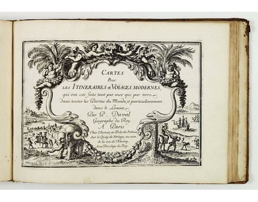
DUVAL, P. - Diverses cartes et tables pour la géographie ancienne, pour la chronologie et pour les itinéraires et voyages modernes.
 Click on image to zoom

DUVAL, P. - Diverses cartes et tables pour la géographie ancienne, pour la chronologie et pour les itinéraires et voyages modernes.
Published: Paris, l'Auteur, s.d., ca.1669
Size: 210 x 290mm.
Color: Uncolored
Condition: In-8 oblong ; veau brun (reliure de l'époque restaurée).Traces de mouillures sur le contreplat. Exemplaire frais intérieurement malgré d'infimes trous de vers marginaux n'affectant pas les cartes. - 3 parts in one. 8vo oblong, contemp. Brown calf. Binding used. Small marginal wormholes not affecting the maps, otherwise maps in very good condition. The general title "Diverses cartes et tables… is lacking.
Description
A rare atlas in three parts. Including a fine map of China, Taiwan and Korea "Carte du voyage des Ambassadeurs de la Compagnie Orientale des Provinces Unies, vers le Tartare Empereur de Chine… " (after Jean Nieuhoff, and showing his travels)
The third part contains an arbitrary collection of maps of various voyages and travels to all parts of the world.
The map "la Floride françoise" (first state) records the French attemps at colonising the south-east under the command of Ribaut and Laudonière in the 1560s.
There are three editions of the book : 1665, 1677 and without date. This one not dated (ca. 1669).
7,000€
- Reference N°: 61803
