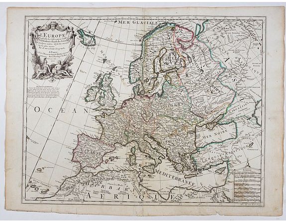
DELISLE, G. - Carte de l'Europe Dressée sur les observations de Mrs de l'Academie Royale des Sciences . . .

DELISLE, G. - Carte de l'Europe Dressée sur les observations de Mrs de l'Academie Royale des Sciences . . .
Published: Paris, 1700
Size: 462 x 590mm.
Color: In original o/l colours.
Condition: Repair of center fold 28cm into engraved area. Paper slightly age-toned as usual.
Description
An early and scarce state of "L’Europe. Chez l’Auteur sur le Quai de l’Horloge a la Couronne de Diamans, 1700".
Guillaume de l'Isle's (1675-1726) well deserved reputation as one of the foremost geographers of the 18th century meant that his maps were influential for many years after his death. De l'Isle eradicated as much as possible imaginary geography in his maps.
The finely engraved map shows Europe divided up into its countries and the adjacent regions Russia, the Middle East and North Africa. In the upper left corner we find the large allegoric title cartouche with a detailed title and dedication to the famous French cartographer Guillaume De L'Isle, on whom the cartographic information of this map is based.
350€
- Reference N°: 41853
2006 views
 Click on image to zoom
