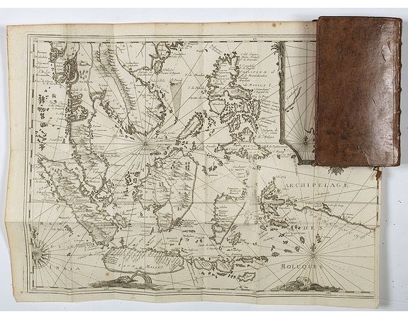
DE RENNEVILLE, R. A. C. - Recueil des voyages qui ont servi à l’établissement et aux progrez de la Compagnie des Indes Orientales, forméedans les Provinces-Unies des Païs-Bas…

DE RENNEVILLE, R. A. C. - Recueil des voyages qui ont servi à l’établissement et aux progrez de la Compagnie des Indes Orientales, forméedans les Provinces-Unies des Païs-Bas…
Published: Rouen, Pierre Le Boucher, 1725
Size: 305 x 425 mm.
Color: Uncoloured.
Condition: Very good condition. Folds as issued. Paper very slightly age toned. Dark impression. ans. Two plates detached from Volumes I and II, wax spots (?) p. 176 of Vol. IV, hole deleting two-word letters from pp. 225-226 of volume IV, small paper scarf in the lower margin of the board opposite p. Volume IX. Clear rednesses. Restorations with some caps and bit, small trace of worm to a box on the back of the volume.
Description
Important richely illustrated compendium of the first Dutch voyages to East India, of great interest for the history and establisment of the Dutch global trade, particularly in America, Asia and Oceania.
Some of the voyages here concern America, especially those of Olivier de Noort around the world by the Strait of Magellan, the trip of George Spilberg to the Moluccas by the same route, and the southern navigation of Jacques Le Maire and Willem Cornelisz Schouten.
Very nice example in uniform contemporary binding, composed of the 10 volumes of the voyages, to which are joined, as often, the 2 volumes of the Voyage of Gautier Schouten in the East Indies.
The volumes are illustrated with 8 frontispieces, a portrait of Schouten and 68 prints and maps, some folding.
Provenance With on the titles ex-libris manuscript Jean-Henri Burckard (1672-1738), botanist and German antique dealer.
Some very nice maps of Philippines and Manilla, among a large folding map : The map is an expanded version of De Bry's "Mar di India", with the inclusion of an inset map of Buton Straits (Botton I. 140x105mm.). The Straits of Buton, highlighted on the map, although narrow, were an important route for ships sailing from Batavia and Makassar to the Moluccas or Spice islands during the northerly monsoons.
5,000€
- Reference N°: 43700
12504 views
Tags:
DE RENNEVILLE
, R. A. C. - Recueil des voyages qui ont servi à l’établissement et aux progrez de la Compagnie des Indes Orientales
, forméedans les Provinces-Unies des Païs-Bas…
, Travel Asia - Oceania
 Click on image to zoom
