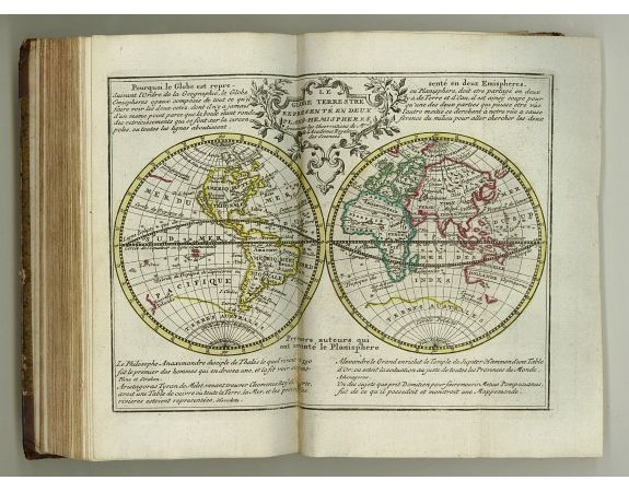
DE LET, H. / BAALDE, S.J. - Nouvel atlas geographique & historique.. / Nieuwe en geographische en historische Atlas..

DE LET, H. / BAALDE, S.J. - Nouvel atlas geographique & historique.. / Nieuwe en geographische en historische Atlas..
Published: Amsterdam 1778
Size: 210 x 120mm.
Color: In original o/l colours.
Condition: Contemp. half, spine ribbed and gilted. Frontispiece, title page, 202pp. description in Dutch of all countries, Empires, index and 42 folding maps.
Description
Second edition of this charming travel compendium which is becoming rather scare now-a-days.
Illustrated with a charming frontispiece, two uncoloured plates of a spheres, a plate of a celestial and terrestrial globe, double hemisphere celestial chart, Decorative continent maps of Asia, Africa, and Europe and a decorative print of a terrestrial and celestial globe and armillary sphere.
The maps are folding out and in fine contemp. Outline colours, with a charming uncoloured title cartouche : world map in two hemispheres prepared by de l'Isle. California as an island.
Europe, Asia, Africa, North America (Amerique Septentrionale qui fait partie des indes occidentales. - California as an island-), South America, England, Denmark, Norway, Finland, Russia, Poland, Germany, Switzerland, Low Countries, Brabant, Gelderland, Flandria, North Holland, South Holland, Zeeland, Utrecht, Friesland, Overijssel, Groningen, France, Spain, Portugal, Italy, Hungary, Yugoslavia, Ottoman Empire, Greece, Crete, two distance tables, a plate with 192 flags of sea faring nations.
2,750€
- Reference N°: 23009
1185 views
 Click on image to zoom
