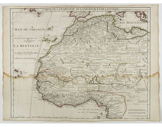
DE L'ISLE, G. - Carte de La Barbarie de La Nigritie et de la Guinée.
 Click on image to zoom

DE L'ISLE, G. - Carte de La Barbarie de La Nigritie et de la Guinée.
Published: Paris, August 1707
Size: 490 x 615mm.
Color: In original o/l colours.
Condition: A dark impression. Water staining at lower part of the map.
Description
A detailed engraved map of north west Africa including the Canary and Cape Verde Islands. Engraved by Inselin. Address and date changed, now with the imprint "A Paris Chez l’Auteur sur le Quai de l’Horloge a l’Aigle d’Or avec Privilege Aout 1707. Lower right, Renard’s imprint is erased. The title is displayed along the top of the map.
In this map De L'Isle corrects his previous impression of the Senegal river, which, in earlier maps, he joined to the Nile by a hypothetical line. He now records the Niger as 'an arm of the Nile'.
Guillaume de L'Isle [Insulanus](1675-1726). French cartographer, pupil of Cassini, called father of modern geography. Member of the Academy of Sciences 1702. Premier Géographe de Roy 1718. Produced over 100 maps and atlases.
Maps were influential for many years after his death. De l'Isle eradicated as much as possible imaginary geography in his maps.
150€
- Reference N°: 41951
