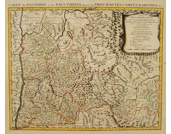
COVENS, J. / MORTIER, C. - Tabula Delphinatus et vicinarum regionum../ Carte de Dauphiné…

COVENS, J. / MORTIER, C. - Tabula Delphinatus et vicinarum regionum../ Carte de Dauphiné…
Published: Amsterdam c. 1745
Size: 500 x 600mm.
Color: In original o/l colours.
Condition: Printed on heavy paper, slightly age-toned as usual. Good impression. Excellent condition.
Description
Shows: Palatium Delphinale, Castrum, Domus Cartusiensis, Praeceptoriae Ordinis S. Johannis Hieros. With decorative title cartouche.
The map is from a Dutch edition of De L'Isle's work entitled, Atlas Nouveau, Contenant Toutes Les Parties Du Monde, Ou sont exactement Remarquées les Empires, Monarchies, Royaumes, Etats, Republiques &c. Par Guillaume de l'Isle. Premier Géographe de sa Majesté. It was published by Covens and Mortier, brothers-in-law who continued the firm established by Pierre Mortier.
The map is from a Dutch edition of De L'Isle's work entitled, Atlas Nouveau, Contenant Toutes Les Parties Du Monde, Ou sont exactement Remarquées les Empires, Monarchies, Royaumes, Etats, Republiques &c. Par Guillaume de l'Isle. Premier Géographe de sa Majesté. It was published by Covens and Mortier, brothers-in-law who continued the firm established by Pierre Mortier.
200€
- See other items by this publisher: COVENS, J. / MORTIER, C.
- Reference N°: 21446
4440 views
 Click on image to zoom
