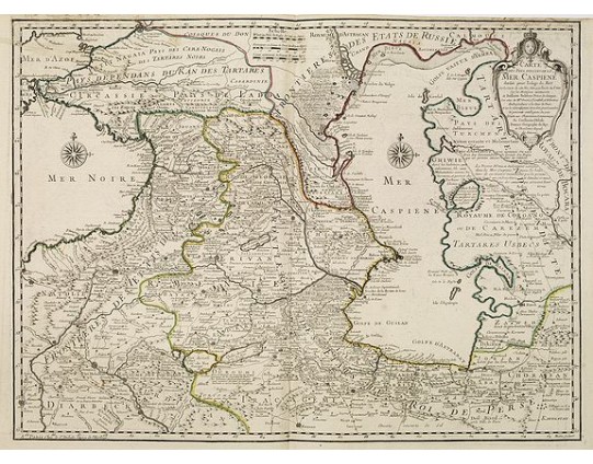
COVENS, J. / MORTIER, C. - Carte des Pays Voisins de la Mer Caspiene dressee pour l' usage du Roy. . .
 Click on image to zoom

COVENS, J. / MORTIER, C. - Carte des Pays Voisins de la Mer Caspiene dressee pour l' usage du Roy. . .
Published: Paris, 1723
Size: 620 x 419mm.
Color: Original o/l colour.
Condition: Printed on heavy paper, slightly age-toned as usual. Good impression. Excellent condition.
Description
The map shows the area east of the Caspian Sea, including parts of Kazakhstan, Turkmenistan, Uzbekistan, and northern Iran. The area eastward from the Caspian is marked 'ROYAUME DE CORGANG ou DE CAREZEM TARTARES UZBECS. '
It is a finely engraved map that shows many trade / caravan routes, forts, cities, villages, and topography and is filled with notations.
Prepared by the prominent French map maker G.de l'Isle, the map is embellished with a title cartouche featuring the French crown and coat of arms. It presents two beautiful Caspian and Black Seas compass roses.
Engraved by Marin.
600€
- See other items by this publisher: COVENS, J. / MORTIER, C.
- Reference N°: 28834
