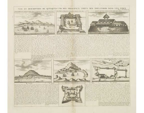
CHATELAIN, H. - Vue et Description de Quelques-Uns des Principaux Forts des Hollandois dans les Indes .
 Click on image to zoom

CHATELAIN, H. - Vue et Description de Quelques-Uns des Principaux Forts des Hollandois dans les Indes .
Published: Amsterdam, 1720
Size: 370 x 432mm.
Color: Uncoloured.
Condition: Some light browning along center fold. Very good impression.
Description
Interesting sheet with seven detailed views illustrating the most important Dutch trading outposts and fortified colonial possessions in the East Indies, including 4 harbor views Batavia (Jakarta), Amboina, Ternate, and Solor, and 3 fort plans, with descriptive French text, from Chatelian's monumental 7 volume Atlas Historique. In upper right margin: 'Tom. V. Nro 48. Pag: 128.
Henri Abraham Chatelain (1684 – 1743) was a Huguenot pastor of Parisian origins. He lived consecutively in Paris, St. Martins, London (c. 1710), the Hague (c. 1721) and Amsterdam (c. 1728). He is best known as a Dutch cartographer and more specifically for his cartographic contribution in the seminal seven volume Atlas Historique, plublished from 1705 to 1720.
The atlas, though published anonymously, is generally known to have been the work of the Chatelain family. Groundbreaking for its time, this work included studies of geography, history, ethnology, heraldry, and cosmography.
150€
- See other items by this publisher: CHATELAIN, H.
- Reference N°: 31603
