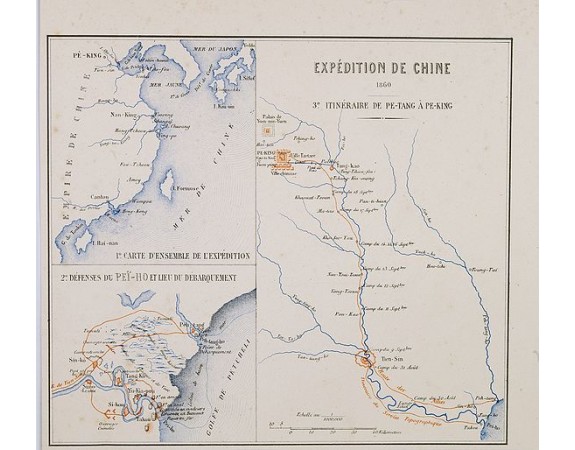
BUREAU, E. - Expédition de Chine 1860 3e itinéraire de Pe-Tang à Pe-King.
 Click on image to zoom

BUREAU, E. - Expédition de Chine 1860 3e itinéraire de Pe-Tang à Pe-King.
Published: Paris, Furne, Jouvet et Cie, 1875
Size: 188 x 221mm.
Color: Lithography in colours.
Condition: Short left and lower margin.
Description
Three maps one sheet, with in upper left a map of the southeast coast of China, including Formosa. Lower left, "2e Défenses du Pei-Hoe et lieu du Débarquement". In right half " Expédition de Chine 1860 3e itinéraire de Pe-Tang à Pe-King.", showing in red the French expedition of 1860. Published in "Atlas de Géographie Militaire adopté par M. le min. de la guerre pour l'école spéciale militaire de Saint-Cyr."
This uncommon atlas included maps of the expeditions of the French army from 1792 until 1861. Prepared by E. Bureau and engraved by Erhard.
This uncommon atlas included maps of the expeditions of the French army from 1792 until 1861. Prepared by E. Bureau and engraved by Erhard.
50€
- See other items by this publisher: BUREAU, E.
- Reference N°: 25922
