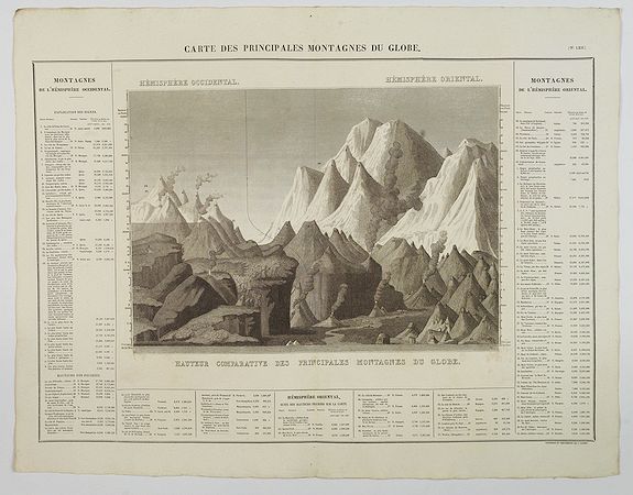
BUCHON, J. A. - Carte des Principales Montagnes du Globe.
 Click on image to zoom

Description
A nice detailed depiction of the principal mountains of the world from Buchon's Atlas Gégraphique Statistique, historique et chronologique des deux Ameriques et des isles adjacentes; traduit de l'atlas exécuté en Amerique d'aprés Lesage, avec des nombreuses corrections et augmentations, Paris 1825. An elegant Parisian publication of the Carey & Lea atlas of the Americas, first published in 1822 in Philadelphia.
The print shows western hemisphere mountains on the left and the eastern
hemisphere mountains on the right, and their comparative heights to each
other. The map is surrounded by letterpress explanatory text (in
French), which includes the relative elevations of important cities,
monuments, etc., the latitude, location and country of each mountain
listed. Text is numbered and lettered which corresponds to the map.
- Reference N°: 44080
