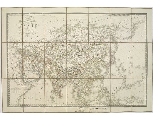
BRUÉ, A. H. - Carte physique et politique de l'Asie.
 Click on image to zoom

Description
This is a detailed map of Asie. It provides very good details of towns in modern-day Uzbekistan. The region is labeled as "Usbecs." The important cities on the Silk Road are mentioned: Bokara (Bukhara), Samarcand (Samarkand), Taskant (Tashkent), etc.
The map is filled with contemporary annotations in brown ink, including several routes along the ancient Silk Route. It looks like the previous owner used the map to mark the centenary of a 19th-century Silk Route journey.
Prepared by Adrien-Hubert Brué. The map has many manuscript annotations in red and brown ink. Several distances measured from St. Petersburg are added in "verstes", an obsolete Russian unit of length equivalent to about 1.067 kilometers (0.6629 miles).
- Reference N°: 30625
