Travel Europe
The Silk Road extended approximately 6,437 kilometers (4,000 miles) across some of the world’s most formidable landscapes, including the Gobi Desert, the Pamir Mountains and traversed several of Uzbekistan’s major cities, including Samarkand, Bukhara and Khiva. The roads were typically in poor condition. Robbers were common. To protect themselves, traders joined together in caravans with camels or other pack animals. Over time, large inns called caravanserais cropped up to house travelling merchants.
One of the most famous travelers of the Silk Road was Marco Polo (1254 C.E. –1324 C.E.). Born into a family of wealthy merchants in Venice, Italy, Marco traveled with his father to China (then Cathay) when he was just 17 years of age.
It is hard to overstate the importance of the Silk Road on history. Religion and ideas spread along the Silk Road just as fluidly as goods. Towns along the route grew into multicultural cities.
The exchange of information gave rise to new technologies and innovations that would change the world.
The below antique maps are available for immediate sale, they are sold with a certificate of authenticity and published at the date indicated in the catalog description.
One of the most famous travelers of the Silk Road was Marco Polo (1254 C.E. –1324 C.E.). Born into a family of wealthy merchants in Venice, Italy, Marco traveled with his father to China (then Cathay) when he was just 17 years of age.
It is hard to overstate the importance of the Silk Road on history. Religion and ideas spread along the Silk Road just as fluidly as goods. Towns along the route grew into multicultural cities.
The exchange of information gave rise to new technologies and innovations that would change the world.
Antique maps including the Silk Route region
The below antique maps are available for immediate sale, they are sold with a certificate of authenticity and published at the date indicated in the catalog description.
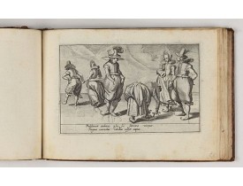
Location: 1618
Published: Amsterdam, Johannes Janssonius, 1618
Size: 130 x 180mm.
Color: Uncoloured
Condition: Oblong 8vo (text) & small oblong 4to (plates) (13 x 18 cm). With 2 portraits, 8 engraved armorial plates. The first 2 sheets of text are cropped and have extended lower margins. These are followed by 30 engraved views or scenes most with a Latin text at the foot. Interleaved. Contemp. calf, gold-tooled spine.
Charming book illustrated with portraits of Willem of Orange and Prince Maurits and , 8 engraved armorial plates. Followed by..
4,500€
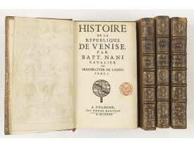
Location: 1682
Published: A Cologne, Chez Pierre Marteau, 1682
Size: 160 x 100mm.
Color: Uncoloured
Condition: 4 volumes in-12 de (36) + 228 + 4 planches hors-texte, 263 + 6 planches h-t ; 268 + 8 planches h-t, 364 + 8 planches h-t. ; veau havanne, dos à nerfs orné, tr. dor. (reliure de l'époque).
L' Histoire de la république de Venise Historia della Republica Veneta (dal 1613 al 1671), en italien, qui va de 1613 à 1671,..
1,650€
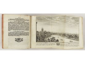
Location: 1773
Published: Zurich, Johann Kaspar Ziegler, 1754-1773
Size: 206 x 167 mm.
Color: Uncoloured.
Condition: 4to. 3 parts in 3 volumes, titles printed in red and black, frontispiece and 326 engraved views, plans and maps (most folding). Contemporary vellum, titles printed in gold on spines. - 1rst volume : [1] leaf, [2], VIII, [34], 15, pp, page 3 to 98 (page 1 missing), page 103 to 270 (two times pages 193 to 196), [6] pp. - 2nd volume : [2] leaves, page 173 to 257 (wrong numbered), page 459 to 476, 277 to 442 (wrong numbered). - 3rd volume : [1] leaf, [6], 8 pp, page 1 to 22, 25 to 30, 34 to 38, 41 to 59 (recto), 224 (verso) to 225, 62 (verso) to 70.
HERRLIBERGER, D. - Neue und vollständige Topographie der Eidgnossschaft, in welcher die in den dreyzehen und zugewandten auc..
5,000€
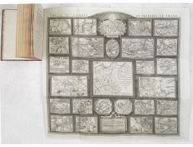
Location: 1788
Published: Potzdam, Strasbourg, Paris, 1788
Size: 590 x 640 mm.
Color: In original o/l colours.
Condition: 4to. 92pp. with large folding map. Contemp. mottled calf, with raised spine in 6 compartments. Richly gilted with coats of arms of Ducs of Luynes, and title on red morocco label.
MULLER, L. - Tableau des guerres de Frédéric le Grand: ou plans figurés de vingt-six batailles rangées, ou combats essentiel..
4,500€
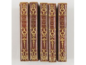
Location: 1827
Published: Paris, Thiériot, 1827
Size: 150 x 100 mm.
Color: Uncoloured.
Condition: 5 volumes in half marocco, spine richly gitted. Pages a very little browned, and binding a little bit rubbed, but generally in very good condition.
BRIAND, P.-C. - Les jeunes voyageurs en Europe, ou description raisonnée des divers pays compris dans cette partie du monde...
1,000€
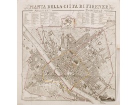
Location: 1839
Published: Florence, Gaspard Ricci, 1839
Size: 192 x 120 mm.
Color: In original o/l colours.
Condition: 8vo. (1), 288 pp. Original publisher's paperboard. With 1 engr. folding plan and 12 copper plates with views in Florence. Very clean copy.
BULGARINI, A. - Guide de Florence et de ses environs Redige´ sur un plan entierement nouveau par l'Abbé A. Bulgarini et Trad..
500€
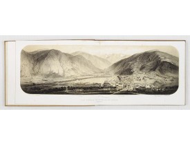
Location: 1850
Published: Paris, ca. 1850
Size: 4to.
Color: Uncolored.
Condition: In-4 oblong de (1) f. de titre et 21 pl. ; pleine toile bordeaux, titre et adresse bibliographique dorés sur le plat supérieur, tranches dorées (cartonnage de l'époque). Cartonnage passé et taché, rousseurs éparses tout au long de l'ouvrage.
GORSE. - Luchon et ses environs. - 23749 - - GORSE. - Luchon et ses environs. - 23749 -..
400€
Showing 1 to 7 of 7 (1 Pages)

