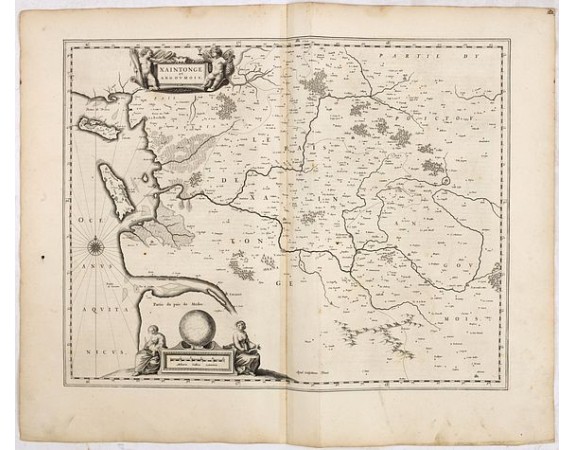
BLAEU, W. - Xaintonge et Angoumois.

BLAEU, W. - Xaintonge et Angoumois.
Published: Amsterdam, 1634
Size: 392 x 500mm.
Color: Uncoloured.
Condition: In good condition. With a mild map crease, a few rust marks and spots, slight dicolouration along centerfold. Good margins and dark impression.
Description
FIRST EDITION, FIRST ISSUE OF THIS MAP. From the 1634 edition of Blaeu's Atlas Novus, the first edition of this work.
Map of Province de Saintonge in the west of France. Including the Isle de Ré and d'Oléron, La Rochelle and the mouth of the Garonne, Angoulesme, including the famous city of Cognac (Congnac).
Saintonge was the birthplace of the famous French explorer Samuel de Champlain. The title cartouche is attended by a pair of cherubs clutching local produce in their hands, and two female figures flank a globe and the scale of miles.
German text on verso.
From an incomplete example of the 1634 German text edition of Blaeu's "Novus Atlas", previously owned by Johann Christoph Gesen (1639), Johann Rudolph von Metzradt (1651), Friedrich August II, King of Saxony (1797-1854).
P. van der Krogt mentions two variants for the German 1634 text edition and only two examples containing proof states (Bad Münstereifel and Gotha).
200€
- See other items by this publisher: BLAEU, W.
- Reference N°: 36037
881 views
 Click on image to zoom
