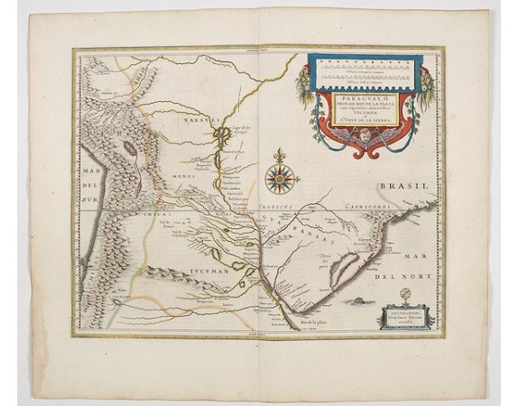
BLAEU, W. - Paraguayo prov. de Rio de La Plata cum regionibus..
 Click on image to zoom

BLAEU, W. - Paraguayo prov. de Rio de La Plata cum regionibus..
Published: Amsterdam, 1644
Size: 373 x 481mm.
Color: In attractive strong original colours.
Condition: Good margins. In very good condition. French text on verso.
Description
A beautiful map of Paraguay, and parts of Peru, Chile, Argentina, Brazil and Bolivia. Much of the area was still "Terra Incognita" so there are few towns and cities shown. The Andes are clearly shown to the west as well as the river systems.
The Renaissance cartouche adds a special decorative accent to the map. The small cartouche in the lower right gives the name of the publisher.
From early on Willem Jansz. Blaeu aimed of publishing an atlas to compete with the Hondius-Jansson Atlas. By 1630, he had published at least 17 folio size maps.
Blaeu was able to realize his plan soon after he had acquired the copper plates of the atlas maps by Jodocus Hondius. The "Appendix followed in 1630.
In 1635 he finally realized a "international edition" of a world atlas, the "Theatrum Orbis Terrarum".
500€
- See other items by this publisher: Willem Blaeu
- Reference N°: 45173
