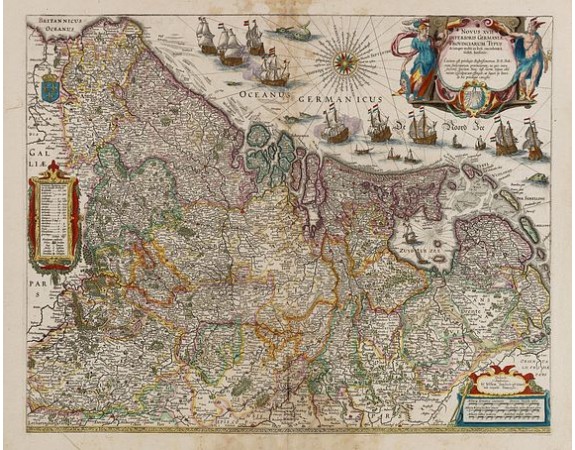
BLAEU, W. - Novus XVII Inferioris Germaniae Provinciarum Typus.

BLAEU, W. - Novus XVII Inferioris Germaniae Provinciarum Typus.
Published: Amsterdam, 1635
Size: 402 x 503mm.
Color: In attractive strong original colours.
Condition: Paper slightly age-toned. Some water staining in upper and lower part. French text on verso.
Description
Willem Blaeu published this map in 1608 as a wall map with figured borders. When later, in 1630 he needed a general map of the Netherlands for his first atlas, the Appendix, the decoration in the borders was sacrificed: the borders of the copper plates were cut off. One of the most decorative maps of present Netherlands, Belgium and Luxembourg.
Still with the signature of "Willem Janszoon op't Water in de Vergulde Zonnewyzer."
As Willem Blaeu died in 1638 most of his maps are actually published by his son Joan. This maps carries his (engraved) signature and was actually published in volume II of a French edition of his "Le Theatre du Monde ou Nouvel Atlas", dated 1638, therefore published the last year of his life.
From early on Willem Jansz. Blaeu aimed of publishing an atlas to compete with the Hondius-Jansson Atlas. By 1630, he had published at least 17 folio size maps. Blaeu was able to realize his plan soon after he had acquired the copper plates of the atlas maps by Jodocus Hondius. The "Appendix followed in 1630.
In 1635 he finally realized a "international edition" of a world atlas, the "Theatrum Orbis Terrarum".
This example is from a very rare 1638 French text edition, which has the same copperplates as the 1635 edition, however the text on the verso was reset in two text columns. This edition is the last version the great master printed under his patronage.
800€
- See other items by this publisher: BLAEU, W.
- Reference N°: 35547
892 views
 Click on image to zoom
