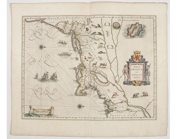
BLAEU, W. - Nova Belgica et Anglia Nova.

BLAEU, W. - Nova Belgica et Anglia Nova.
Published: Amsterdam, 1644
Size: 388 x 505 mm.
Color: In attractive strong original colours.
Condition: French text on verso. Wide margins.
Description
Orientated with north to the right. This is one of the earliest maps to concentrate solely on this area of the colonies, excluding Virginia and the extreme north east coastline of the States.
This would appear to be the first map to include scenes of Indian natives paddling their canoes and also has scenes of Indian villages and habitations, European vessels, animals and birds on each side of the title cartouche. Lake Champlain, as usual in this period, is shown too far to the east.
The coastal strip is well detailed with settlement names, testifying to the Dutch and English interest in the area, but the map is, above all, a fine example of the superb design and craftsmanship employed by the Blaeu's in their work.
Based on the manuscript survey by Adrian Block, completed about the year 1614.
3,000€
- See other items by this publisher: BLAEU, W.
- Reference N°: 45272
2279 views
 Click on image to zoom
