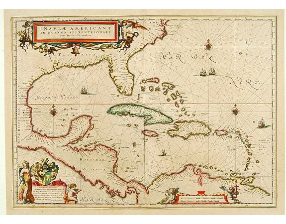
BLAEU, W. - Insulae Americanae in Oceanus Septentrionali cum Terris adiacentibus.

BLAEU, W. - Insulae Americanae in Oceanus Septentrionali cum Terris adiacentibus.
Published: Amsterdam, 1647
Size: 378 x 518mm.
Color: In attactive original colours.
Condition: Paper very slightly age-toned, generally in very good condition. In original colours.
Description
General map of the West Indies extending from Virginia to the mouth of the Orinoco, and destined to be copied in various shapes by many other publishers. Title cartouche top left incorporates various marine fauna. This is a derivative of Hessel Gerritsz' chart of c. 1631. The nomenclature of the North American part is virtually identical, the only notable addition being the naming of VIRGINIA. It reflects the firsthand knowledge of Gerritsz during his voyage to South America and the West Indies undertaken in 1628.
2,000€
- See other items by this publisher: BLAEU, W.
- Reference N°: 08774
2601 views
 Click on image to zoom
