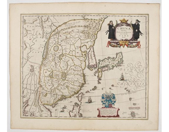
BLAEU, W. - China Veteribus Sinarum Regio.
 Click on image to zoom

BLAEU, W. - China Veteribus Sinarum Regio.
Published: Amsterdam, 1644
Size: 410 x 500mm.
Color: In attractive strong original colours.
Condition: Fine condition.
Description
This was the first of Blaeu's maps of China. In 1655 he was to publish the famous map of Father Martini, with many of the earlier inaccuracies present on this map corrected: the outline of Japan was improved and Korea was correctly shown as a peninsula instead of, as here, an island.
The map includes an attractive cartouche bottom left with coat of arms and dedication to Theodore Bas, director of the V.O.C.
From early on Willem Jansz. Blaeu aimed of publishing an atlas to compete with the Hondius-Jansson Atlas. By 1630, he had published at least 17 folio size maps.
Blaeu was able to realize his plan soon after he had acquired the copper plates of the atlas maps by Jodocus Hondius. The "Appendix followed in 1630.
In 1635 he finally realized a "international edition" of a world atlas, the "Theatrum Orbis Terrarum".
2,200€
- See other items by this publisher: Willem Blaeu
- Reference N°: 45155
