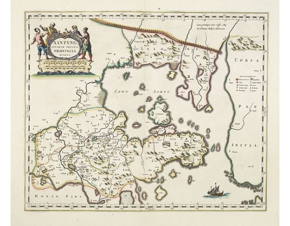
BLAEU, J. - Xantung, sinarum imperii provincia quatra.

BLAEU, J. - Xantung, sinarum imperii provincia quatra.
Published: Amsterdam, ca 1660
Size: 396 x 480mm.
Color: In original colours.
Condition: Very good condition. Good and dark impression.
Description
A map of the northern province ‘Xantung’ of China after the Jesuit Martino Martini.
Shows the Great Wall and is centered on the Bohai Sea, and the Shandong and Liaoning Provinces.
Ornamental figured cartouche and mile scale. In the centre of the map we find the bay of Xang with the neighboring peninsula of Korea. The inland is not filled in but it is one of the earliest representing of showing Korea as an peninsular.
Many larger cities are engraved: Tungchang, Cinan, Yencheu. Laicheu, Leaochang, as well as other small place names. Including rivers, lakes, mountains. At the upper right side is key to cities and villages, rivers, lakes, fortresses, etc. In excellent condition. No text on verso.
The second landmark in the European mapping of China was the appearance of the Novus Atlas Sinensis in 1655. It was compiled by Father Martino Martini, an Italian Jesuit and produced by the most prominent Dutch cartographer of the time, Johannes Blaeu. Father Martini compiled the work based on Chinese sources between 1643 and 1650, and it greatly advanced European knowledge of the region including the astronomical positions of many cities and topographical features. It remained the standard geographical work on that country until the publication in 1737 of D'Anville's Atlas de la Chine.
1,200€
- See other items by this publisher: BLAEU, J.
- Reference N°: 27848
1008 views
 Click on image to zoom
