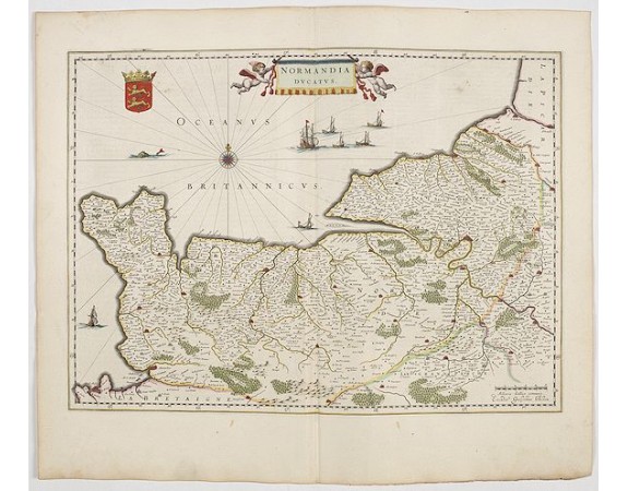
BLAEU, J. - Normandia Ducatus.

BLAEU, J. - Normandia Ducatus.
Published: Amsterdam, 1644
Size: 380 x 520mm.
Color: In original colours.
Condition: A good and dark impression. In very good condition. Some light creasing along center fold.
Description
Very detailed map of Normandy centered on Caen and Rouen. Also showing Cherbourg, Avranches, Bayeux, Cabourg, Honfleur, Le Havre, Etretat, Fecamp. St Malo and Mont Saint Michel appear in the lower left corner. Two putti hold up the draped title cartouche. Shows Mt. St. Michel.
The map is also embellished with a coat of arms, several sailing ships, a wind rose and a sea monster.
From early on Willem Jansz. Blaeu aimed of publishing an atlas to compete with the Hondius-Jansson Atlas. By 1630, he had published at least 17 folio size maps.
Blaeu was able to realize his plan soon after he had acquired the copper plates of the atlas maps by Jodocus Hondius. The "Appendix followed in 1630.
In 1635 he finally realized a "international edition" of a world atlas, the "Theatrum Orbis Terrarum".
350€
- See other items by this publisher: BLAEU, J.
- Reference N°: 45120
2156 views
 Click on image to zoom
